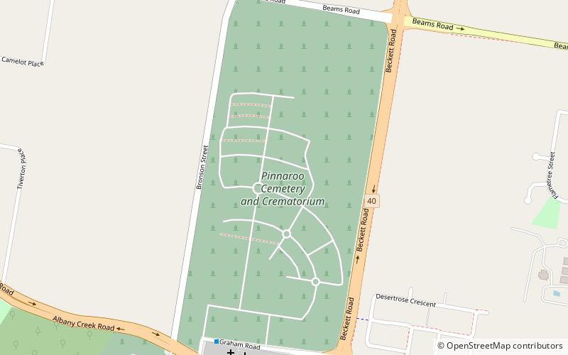
Pinnaroo Cemetery and Crematorium, Brisbane
Map
Facts and practical information
Coordinates: 27°20'53"S, 152°59'38"E
Address
285 Graham RoadBridgeman DownsBrisbane
ContactAdd
Social media
Add
Getting there by public transportation
Public transportation stops near this location
- Bus
 Bus
Bus
- Calculate routeRidley Rd at Retreat Street 21 min walk
- Calculate routeBeams Road near Tintara Street 26 min walk
Day trips


Frequently Asked Questions (FAQ)
How to get to Pinnaroo Cemetery and Crematorium by public transport?
The nearest stations to Pinnaroo Cemetery and Crematorium:
Bus
Bus
- Ridley Rd at Retreat Street • Lines: 680 (21 min walk)
- Beams Road near Tintara Street • Lines: 680 (26 min walk)