Wurundjeri Way, Melbourne

Gallery (1)
Map
Map
Facts and practical information
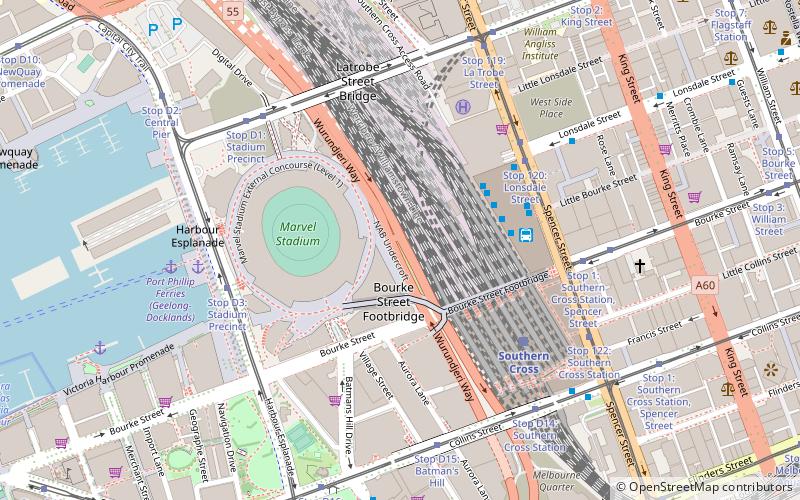
Wurundjeri Way is a 1.9-kilometre road running through the Docklands Development west of the Melbourne central business district. It was constructed in 1999 as part of replanning and development of the former Melbourne rail yards and docks. Wurundjeri Way runs from Montague Street, South Melbourne to Dudley Street, West Melbourne via the Charles Grimes Bridge. ()
Coordinates: 37°49'0"S, 144°56'59"E
Address
City of Melbourne (Docklands)Melbourne
ContactAdd
Social media
Add
Getting there by public transportation
Public transportation stops near this location
- Bus
- Tram
- Train
- Ferry
 Bus
Bus
- Calculate routeSouthern Cross Coach Terminal 4 min walk
- Calculate routeLonsdale Street/Spencer Street 5 min walk
- Calculate routeLa Trobe Street 6 min walk
- Calculate routeSouthern Cross Station 7 min walk
- Calculate routeSouthern Cross 5 min walk
- Calculate routeFlagstaff 13 min walk
- Calculate routeNorth Melbourne 20 min walk
- Calculate routeMelbourne Central 22 min walk
- Calculate routeStop 120: Lonsdale Street 5 min walk
- Calculate routeStop D3: Stadium Precinct 6 min walk
- Calculate routeStop D1: Stadium Precinct 6 min walk
- Calculate routeStop 1: Southern Cross Station, Spencer Street 6 min walk
- Calculate routePort Phillip Ferries 7 min walk
Maps Melbourne TramsMaps
 Victoria Trains
Melbourne TramsMapsVictoria TrainsDay trips


Frequently Asked Questions (FAQ)
Which popular attractions are close to Wurundjeri Way?
Nearby attractions include Etihad Stadium, Melbourne (3 min walk), Victoria Point, Melbourne (5 min walk), Spencer Street Pharmacy, Melbourne (6 min walk), Docklands, Melbourne (6 min walk).
How to get to Wurundjeri Way by public transport?
The nearest stations to Wurundjeri Way:
Bus
Train
Tram
Ferry
Bus
- Southern Cross Coach Terminal • Lines: SkyBus (4 min walk)
- Lonsdale Street/Spencer Street • Lines: 216 (5 min walk)
Train
- Southern Cross (5 min walk)
- Flagstaff (13 min walk)
Tram
- Stop 120: Lonsdale Street • Lines: 86, 86a, 86d (5 min walk)
- Stop D3: Stadium Precinct • Lines: 35, 70, 70d, 75 (6 min walk)
Ferry
- Port Phillip Ferries (7 min walk)