St Andrew's Graveyard, Melbourne
Map
Facts and practical information
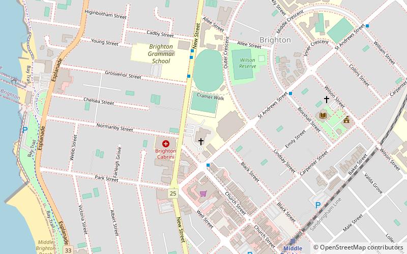
St Andrew's Graveyard, Brighton is the graveyard of St Andrew's Anglican Church, Brighton, Melbourne, Victoria, Australia. The St Andrew's Graveyard is of historical significance as an extremely early, pre-Gold Rush graveyard and as a rare surviving example of such a graveyard in Victoria. ()
Coordinates: 37°54'40"S, 144°59'34"E
Address
Bayside (Brighton)Melbourne
ContactAdd
Social media
Add
Getting there by public transportation
Public transportation stops near this location
- Bus
- Train
 Bus
Bus
- Calculate routeMiddle Brighton 9 min walk
- Calculate routeNorth Brighton 18 min walk
- Calculate routeBrighton Beach 28 min walk
- Calculate routeGardenvale 30 min walk
- Calculate routeMiddle Brighton Station 10 min walk
- Calculate routeNorth Brighton Station 17 min walk
- Calculate routeCentre Road 21 min walk
- Calculate routeHillcrest Avenue 21 min walk
Maps Melbourne TramsMaps
 Victoria Trains
Melbourne TramsMapsVictoria TrainsDay trips


Frequently Asked Questions (FAQ)
Which popular attractions are close to St Andrew's Graveyard?
Nearby attractions include Royal Brighton Yacht Club, Melbourne (11 min walk), Melbourne/Brighton and Caulfield, Melbourne (12 min walk), Brighton Beach, Melbourne (14 min walk).
How to get to St Andrew's Graveyard by public transport?
The nearest stations to St Andrew's Graveyard:
Train
Bus
Train
- Middle Brighton (9 min walk)
- North Brighton (18 min walk)
Bus
- Middle Brighton Station • Lines: 626, 703 (10 min walk)
- North Brighton Station • Lines: 626, 703, 823, Penninsula Express (17 min walk)