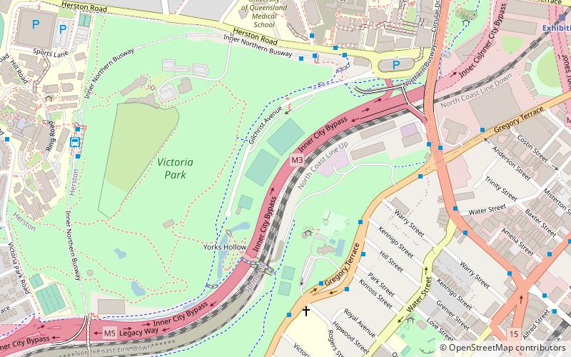
Inner City Bypass, Brisbane
Map

Gallery

Facts and practical information
M3 Inner City Bypass is a 5.6 kilometres major motorway standard bypass in Brisbane, Queensland. Bypassing the Brisbane central business district to the north, it connects Brisbane’s Pacific Motorway and Go Between Bridge at Hale Street to Kingsford Smith Drive, Legacy Way Tunnel, Clem Jones Tunnel, AirportLink Tunnel and Lutwyche Road following the Exhibition railway line for the majority of its length. ()
Coordinates: 27°27'11"S, 153°1'28"E
Address
Spring HillBrisbane
ContactAdd
Social media
Add
Day trips
Inner City Bypass – popular in the area (distance from the attraction)
Nearby attractions include: Fortitude Valley, McWhirters, Brunswick Street Mall, Spring Hill Baths.
Frequently Asked Questions (FAQ)
Which popular attractions are close to Inner City Bypass?
Nearby attractions include Victoria Park, Brisbane (5 min walk), Marks-Hirschfeld Museum of Medical History, Brisbane (9 min walk), Old Museum Building, Brisbane (9 min walk), Herston, Brisbane (10 min walk).
How to get to Inner City Bypass by public transport?
The nearest stations to Inner City Bypass:
Bus
Train
Ferry
Bus
- Herston station, platform 1 • Lines: 330, 333 (6 min walk)
- Herston station, platform 2 • Lines: 330, 333, N339 (6 min walk)
Train
- Exhibition (14 min walk)
- Fortitude Valley (16 min walk)
Ferry
- Holman Street Ferry Terminal • Lines: Chop-400, Xrvr-400 (27 min walk)
- Eagle Street Pier Ferry Terminal • Lines: Chop-400, Xrvr-400 (30 min walk)


