Woollahra House, Sydney
Map
Facts and practical information
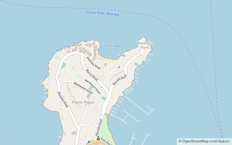
Woollahra House refers to two mansions built on the same site in Point Piper, Sydney, New South Wales, Australia. The first house was built in 1856 by Sir Daniel Cooper and the second by his son, William Charles Cooper, in 1883. Both houses have been demolished, but two buildings still remain from the original structure. The gatekeeper's lodge from Sir Daniel Cooper's house, which was built in 1871, is now the Rose Bay Police Station, and the stables which are now Wyuna Court, a prestigious block of apartments. These buildings in the Municipality of Woollahra are of some historical interest. ()
Coordinates: 33°51'57"S, 151°15'14"E
Address
Eastern Suburbs (Point Piper)Sydney
ContactAdd
Social media
Add
Getting there by public transportation
Public transportation stops near this location
- Bus
- Train
- Ferry
 Bus
Bus
- Calculate routeRose Bay Wharf 15 min walk
- Calculate routeDouble Bay Wharf 21 min walk
- Calculate routeDarling Point 22 min walk
- Calculate routeEdgecliff Station, Stand K 36 min walk
- Calculate routeEdgecliff 36 min walk
Maps Sydney TrainsMaps
 Sydney Light RailMaps
 Sydney Ferries
Sydney TrainsMapsSydney Light RailMapsSydney FerriesDay trips


Frequently Asked Questions (FAQ)
Which popular attractions are close to Woollahra House?
Nearby attractions include Wolseley Road, Sydney (7 min walk), Rose Bay Sea Wall, Sydney (12 min walk), Shark Island, Sydney (15 min walk), Gladswood House, Sydney (17 min walk).
How to get to Woollahra House by public transport?
The nearest stations to Woollahra House:
Ferry
Bus
Train
Ferry
- Rose Bay Wharf • Lines: F7 (15 min walk)
- Double Bay Wharf • Lines: F7 (21 min walk)
Bus
- Edgecliff Station, Stand K • Lines: 200 (36 min walk)
Train
- Edgecliff (36 min walk)