Pinswang
#402 among destinations in Austria
Facts and practical information
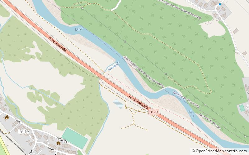
Pinswang is a municipality in the Austrian Ausserfern region of the northern Tyrol. It lies on the border with the Allgäu region of Bavaria in Germany. ()
Pinswang – popular in the area (distance from the attraction)
Nearby attractions include: Ehrenberg Castle, Säuling, Alpentherme, Rote Flüh.
4.9 miSSpecialty museum, Museum, Historical placeEhrenberg Castle, Reutte
124 min walk • Ehrenberg Castle is a castle located in Reutte in Tyrol, Austria.
3.3 miENatural attraction, Nature, MountainSäuling
84 min walk • Rising majestically above the Austrian landscape, the Säuling is a prominent mountain that beckons adventurers and nature enthusiasts alike. Situated on the border between Austria and Germany, this alpine marvel stands at an impressive altitude of 2,047 meters...
3.9 miSE 4.2 miSWNature, Natural attraction, MountainRote Flüh
106 min walk • For the "Rote Flüh" feature on the North Face of the Eiger, see Eiger. The Rote Flüh is a peak in the Tannheim Mountains, a sub-range of the Allgäu Alps. It is 2,108 metres high. The Rote Flüh is built from Wetterstein limestone.
5 miSBridgeHighline179, Reutte
128 min walk • Highline179 is located near Reutte on the Bavarian-Austrian Border, it extends at an altitude of 114 meters above the Ehrenberg castle and connects the Ehrenberg ruins with Fort Claudia.
3.2 miNWForts and castlesVilsegg Castle, Vils in Tirol
81 min walk • Vilsegg Castle is a former fortification in the Austrian state of Tyrol that stands about a kilometre northwest of the little town of Vils, between Pfronten and Füssen, a few hundred metres away from the Austro-German border.
6.8 miSENature, Natural attraction, LakeHeiterwanger See
174 min walk • Lake Heiterwang is a lake in the Tirol, Austria, located at 47°27′30″N 10°46′50″E. Its surface is approximately 1.37 km² and its maximum depth is 61 metres. It is well-known Heiterwanger See is good for fishing. Kaiser Maximilian I of Austria often fished here.
5.7 miSWScenic alpine lake for swimming and hikingHaldensee
146 min walk • Haldensee is a lake of Tyrol, Austria. It is located on an altitude of 1124 m ü. A. in the Tannheimer Tal between Grän and Nesselwängle and has a size of 73 hectares.
3.9 miSWNature, Natural attraction, MountainGimpel Mountain
101 min walk • The Gimpel is a peak in the Tannheim Mountains, a sub-range of the Allgäu Alps. It is 2,173 m high. The name is derived from the Gimpelalpe alp in der "hollow". The Gimpel is made of Wetterstein limestone.
4.3 miSWNature, Natural attraction, MountainSchartschrofen
109 min walk • The Schartschrofen is a rocky summit, 1,968 m high, in the Tannheim Mountains, a sub-group of the Allgäu Alps. It lies northwest of the Rote Flüh and south of the col of Füssener Jöchl.
3.4 miSWNature, Natural attraction, MountainKellenspitze
87 min walk • The Kellenspitze, often also called the Kellespitze or Köllenspitze, at 2,238 m is the highest peak in the Tannheim Mountains. It lies in the Austrian state of Tyrol.