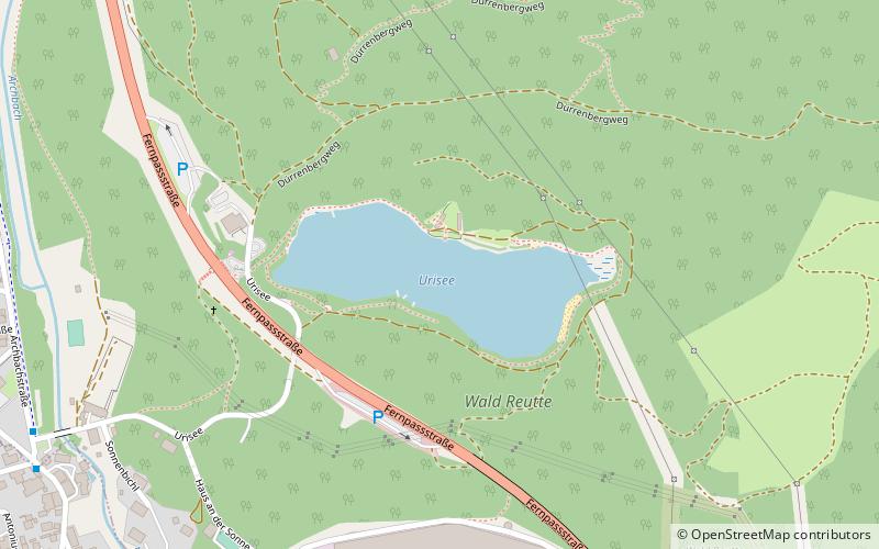
Urisee
#388 among destinations in Austria

Facts and practical information
Urisee is a lake of Tyrol, Austria. ()
TyrolAustria
Urisee plan & book
Unleash the traveler in you — discover the cheapest flight deals, find the perfect hotel or hostel nearby, and search for the best car rental prices. Travel at your own pace to discover new places and enjoy your journey.
Urisee – popular in the area (distance from the attraction)
Nearby attractions include: Ehrenberg Castle, Plansee, Säuling, Alpentherme.
 Specialty museum, Museum, Historical place
Ehrenberg Castle, Reutte
66 min walk • Ehrenberg Castle is a castle located in Reutte in Tyrol, Austria.
 Scenic lake for water and land activities
Plansee
99 min walk • Nestled in the heart of the Tyrolean Alps, Plansee is a stunning alpine lake that offers a serene escape amidst the rugged beauty of Austria. This natural gem is the second largest lake in Tyrol and is known for its crystal-clear waters that mirror the majestic...
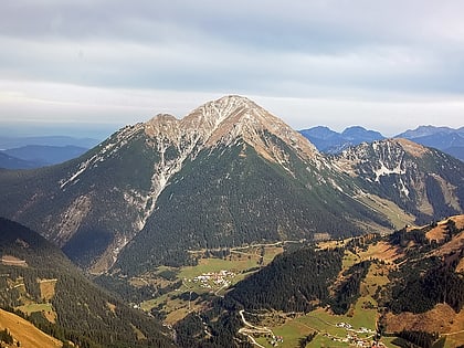
 Natural attraction, Nature, Mountain
Säuling
64 min walk • Rising majestically above the Austrian landscape, the Säuling is a prominent mountain that beckons adventurers and nature enthusiasts alike. Situated on the border between Austria and Germany, this alpine marvel stands at an impressive altitude of 2,047 meters...

 Bridge
Highline179, Reutte
68 min walk • Highline179 is located near Reutte on the Bavarian-Austrian Border, it extends at an altitude of 114 meters above the Ehrenberg castle and connects the Ehrenberg ruins with Fort Claudia.
 Nature, Natural attraction, Lake
Heiterwanger See
87 min walk • Lake Heiterwang is a lake in the Tirol, Austria, located at 47°27′30″N 10°46′50″E. Its surface is approximately 1.37 km² and its maximum depth is 61 metres. It is well-known Heiterwanger See is good for fishing. Kaiser Maximilian I of Austria often fished here.
 Nature, Natural attraction, Mountain
Thaneller
131 min walk • Thaneller is a mountain of the Lechtal Alps, a sub-range of the Northern Limestone Alps in Tyrol, Austria. It is a prominent, free standing pyramidal peak located near Ehrwald, on the northwestern edge of the Lechtals.
 Nature, Natural attraction, Mountain
Kohlbergspitze
129 min walk • The Kohlbergspitze is a 2,202 m high summit on the main chain of the Ammergau Alps in Tyrol, Austria. Less common names for the mountain are the Zigersteinjoch, Stapferwiesjoch and Zigerstein.
 Nature, Natural attraction, Mountain
Kellenspitze
133 min walk • The Kellenspitze, often also called the Kellespitze or Köllenspitze, at 2,238 m is the highest peak in the Tannheim Mountains. It lies in the Austrian state of Tyrol.
 Nature, Natural attraction, Lake
Frauensee
54 min walk • Frauensee is a lake in the Reutte District of Tyrol, Austria. It is approximately 1 acre and is 972 metres above sea level. The lake is in the Lechaschau municipality at the eastern foot of Gehrenspitze in the Tannheim Mountains.
 Locality
Pinswang
91 min walk • Pinswang is a municipality in the Austrian Ausserfern region of the northern Tyrol. It lies on the border with the Allgäu region of Bavaria in Germany.


