Kuchenspitze
#598 among destinations in Austria


Facts and practical information
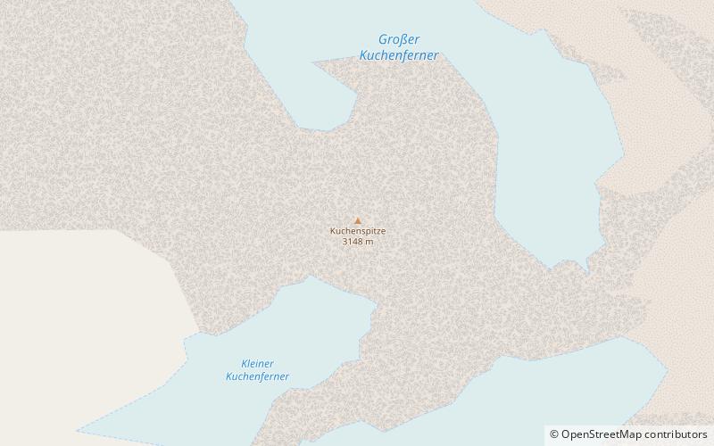
The Kuchenspitze is a mountain, 3,148 m, in the Verwall between the valley of Stanzer Tal and Paznaun in the west of North Tyrol. ()
TyrolAustria
Kuchenspitze – popular in the area (distance from the attraction)
Nearby attractions include: Greitspitz, Patteriol, Bürkelkopf, Scheibler Mountain.
7.3 miSE
Nature, Natural attraction, MountainGreitspitz
187 min walk • The Greitspitz is a mountain of the Samnaun Alps, located on the border between Switzerland and Austria. It lies approximately halfway between Samnaun and Ischgl. In winter it is part of the ski area Silvretta Arena.
2 miW
Nature, Natural attraction, MountainPatteriol
52 min walk • The Patteriol is a mountain in the Verwall Alps in the Austrian state of Tyrol. It has an elevation of 3,056 m. In old literature the elevation is stated higher: 3,059 m or 10,037 ft.
6.9 miSE
Nature, Natural attraction, MountainBürkelkopf
176 min walk • Bürkelkopf is a mountain of the Samnaun Alps, located on the border between Austria and Switzerland. It lies between Ischgl and Samnaun. In winter it is part of a ski area.
0.8 miNW
Nature, Natural attraction, MountainScheibler Mountain
21 min walk • Scheibler is a 2,978 m high mountain in the Verwall Alps in the Austrian state Tyrol. There are directs ascents from two alpine club huts: From Darmstädter Hütte in two hours. From Konstanzer Hütte in three hours. Both ascents meet at Kuchenjöchli, the 2,730-metre-high col between Scheibler and Kuchenspitze.
5 miNW
Nature, Natural attraction, MountainPflunspitzen
129 min walk • The Pflunspitzen are the highest points in the western Verwall Group in the Austrian Alps, reaching a maximum height of 2,912 m. They lie west of the neighbouring Kaltenberg; the nearest village is Klösterle by Arlberg north of the peaks.
6 miS
5.7 miN
4.5 miSW
Nature, Natural attraction, MountainGaisspitze
116 min walk • The Gaisspitze is a cone shaped mountain in the Verwall Alps in the Austrian state of Tyrol and north of the municipality Galtür. It has an elevation of 2,779 m. The nearest taller mountain is the Glatter Berg, about 1 km north. They are separated via the col Muttenjoch.
3.8 miSE
TownIschgl
98 min walk • In addition to its world-class skiing, Ischgl is also known for its vibrant apres-ski scene, with numerous bars and restaurants offering a lively atmosphere and delicious Austrian cuisine. After a day on the slopes, visitors can unwind with a glass of gluhwein...
1.9 miE
Nature, Natural attraction, MountainSaumspitze
48 min walk • The Saumspitze is a 3,039 m mountain in the Verwall Alps, a mountain range of the Central Eastern Alps. It is situated in the West of the Austrian state of Tyrol.
0.5 miS
Nature, Natural attraction, MountainKüchlspitze
14 min walk • The Küchlspitze is a three-thousander in the Verwall between the valley of Stanzer Tal and Paznaun in the western North Tyrol in Austria.
