Gaisspitze
#554 among destinations in Austria


Facts and practical information
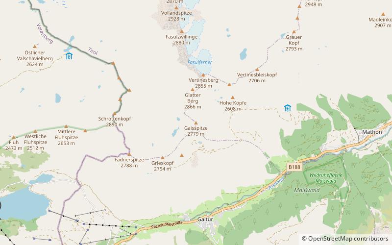
The Gaisspitze is a cone shaped mountain in the Verwall Alps in the Austrian state of Tyrol and north of the municipality Galtür. It has an elevation of 2,779 m. ()
TyrolAustria
Gaisspitze plan & book
Unleash the traveler in you — discover the cheapest flight deals, find the perfect hotel or hostel nearby, and search for the best car rental prices. Travel at your own pace to discover new places and enjoy your journey.
Gaisspitze – popular in the area (distance from the attraction)
Nearby attractions include: Bielerhöhe Pass, Patteriol, Scheibler Mountain, Alpinarium Galtür.
6.7 miSWNature, Natural attraction, MountainBielerhöhe Pass, Gemeinde Gaschurn-Partenen
170 min walk • The Bielerhöhe connects the Montafon valley in Vorarlberg with the Paznaun valley in Tirol. At 2,037 m above sea level, the Bielerhöhe lies in the Vorarlberg region, due north of the Silvretta Reservoir.
3.7 miNNature, Natural attraction, MountainPatteriol
94 min walk • The Patteriol is a mountain in the Verwall Alps in the Austrian state of Tyrol. It has an elevation of 3,056 m. In old literature the elevation is stated higher: 3,059 m or 10,037 ft.
5 miNNature, Natural attraction, MountainScheibler Mountain
128 min walk • Scheibler is a 2,978 m high mountain in the Verwall Alps in the Austrian state Tyrol. There are directs ascents from two alpine club huts: From Darmstädter Hütte in two hours. From Konstanzer Hütte in three hours. Both ascents meet at Kuchenjöchli, the 2,730-metre-high col between Scheibler and Kuchenspitze.
1.6 miS 4.5 miNENature, Natural attraction, MountainKuchenspitze
116 min walk • The Kuchenspitze is a mountain, 3,148 m, in the Verwall between the valley of Stanzer Tal and Paznaun in the west of North Tyrol.
5.3 miETownIschgl
137 min walk • In addition to its world-class skiing, Ischgl is also known for its vibrant apres-ski scene, with numerous bars and restaurants offering a lively atmosphere and delicious Austrian cuisine. After a day on the slopes, visitors can unwind with a glass of gluhwein...
5.8 miNENature, Natural attraction, MountainSaumspitze
148 min walk • The Saumspitze is a 3,039 m mountain in the Verwall Alps, a mountain range of the Central Eastern Alps. It is situated in the West of the Austrian state of Tyrol.
4.2 miNENature, Natural attraction, MountainKüchlspitze
107 min walk • The Küchlspitze is a three-thousander in the Verwall between the valley of Stanzer Tal and Paznaun in the western North Tyrol in Austria.
5.1 miENature, Natural attraction, ValleyFimbatal
131 min walk • The Fimbatal, also Fimbertal, is an alpine valley situated between the Silvretta Alps and the Samnaun Alps. The valley is drained by the Fimbabach river, a tributary of the Inn basin at Ischgl. The highest mountain bordering the Fimbatal is the Fluchthorn.
1.5 miEAlpine hut, HikingFriedrichshafener Hütte
40 min walk • The Friedrichshafener Hütte is a refuge of the Friedrichshafen Section of the German Alpine Club on the Tyrolean side of the Verwall in Austria.
5.2 miNEAlpine hut, HikingDarmstädter Hütte
133 min walk • The Darmstädter Hütte is an alpine club hut of the Darmstadt-Starkenburg Section of the German Alpine Club in the municipality of St. Anton am Arlberg in the Verwallgruppe in Tyrol.