Landplagenbild, Graz
Map

Map

Facts and practical information
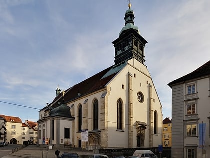
The Landplagenbild, also called "God's plague picture", is located on the southern outer wall of Graz Cathedral. The fresco, painted in 1485, is believed to be the work of Thomas von Villach. It is considered one of the most historically and artistically important frescoes in Styria.
Coordinates: 47°4'18"N, 15°26'31"E
Address
Innere StadtGraz
ContactAdd
Social media
Add
Day trips
Landplagenbild – popular in the area (distance from the attraction)
Nearby attractions include: Styrian Armoury, Murinsel, Franciscan Church, Graz Opera.
Frequently Asked Questions (FAQ)
Which popular attractions are close to Landplagenbild?
Nearby attractions include Diözesanmuseum Graz, Graz (1 min walk), Katharinenkirche und Mausoleum, Graz (1 min walk), Schauspielhaus, Graz (2 min walk), Doppelwendeltreppe, Graz (2 min walk).
How to get to Landplagenbild by public transport?
The nearest stations to Landplagenbild:
Bus
Tram
Train
Bus
- Schauspielhaus • Lines: 30 (2 min walk)
- Palais Trauttmansdorff/Urania • Lines: 30 (2 min walk)
Tram
- Hauptplatz/Congress • Lines: 1, 3, 4, 5, 6, 7 (5 min walk)
- Schloßbergplatz/Murinsel • Lines: 3, 5 (8 min walk)
Train
- Fairytale Express (7 min walk)
- Schloßbergbahn Bergstation (10 min walk)


