Schneiderspitze, Axamer Lizum

Gallery (1)
Map
Map
Facts and practical information
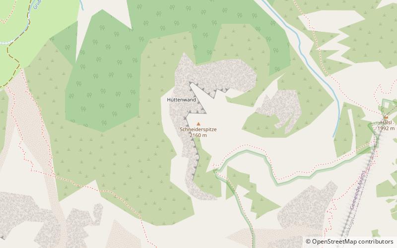
The Schneiderspitze is a peak north of the Ampferstein in the Kalkkögeln, which belong to the Stubai Alps.
Towards the north and west, the Schneiderspitze slopes down to the Axamer Lizum with imposing rock faces. The lower rock face bears the designation Hüttenwand. The summit can be reached on easy paths, either from the Lizumer Kar in the west or from Halsl 1992 m in the east, the saddle between the Ampferstein and the Nockspitze. In winter the Schneiderspitze is also a destination for ski tourers. The ascent from Axamer Lizum via Halsl takes about 1.5 hours of walking.
Address
Axamer Lizum
ContactAdd
Social media
Add
Getting there by public transportation
Public transportation stops near this location
- Bus
 Bus
Bus
- Calculate routeAxamer Lizum 20 min walk
Day trips


Frequently Asked Questions (FAQ)
Which popular attractions are close to Schneiderspitze?
Nearby attractions include Widdersberg, Axamer Lizum (16 min walk), Ampferstein, Axamer Lizum (20 min walk), Marchreisenspitze, Axamer Lizum (22 min walk).
How to get to Schneiderspitze by public transport?
The nearest stations to Schneiderspitze:
Bus
Bus
- Axamer Lizum • Lines: 4162, L1, L2 (20 min walk)