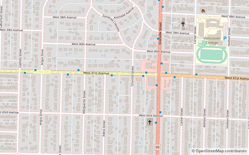
South Granville Rise, Vancouver

Gallery (1)
Map
Map
Facts and practical information
Coordinates: 49°14'3"N, 123°8'31"W
Getting there by public transportation
Public transportation stops near this location
- Metro
- Bus
- Trolleybus
 Metro
Metro
- Calculate routeWest 41st Ave at Adera St 2 min walk
- Calculate routeGranville St at West 41st Ave 3 min walk
- Calculate routeWest 41st Ave at Granville St 2 min walk
- Calculate routeGranville St at West 41st Ave 3 min walk
- Calculate routeOakridge-41st Avenue 30 min walk
- Calculate routeLangara-49th Avenue 33 min walk
Maps SkyTrain
SkyTrainDay trips


Frequently Asked Questions (FAQ)
Which popular attractions are close to South Granville Rise?
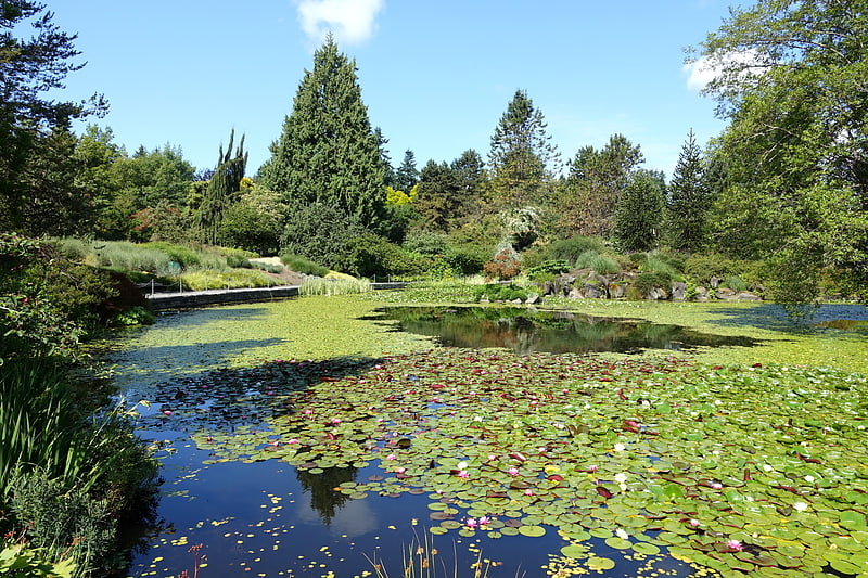
Nearby attractions include VanDusen Botanical Garden, Vancouver (15 min walk), Unitarian Church of Vancouver, Vancouver (21 min walk), Shaughnessy, Vancouver (22 min walk).
How to get to South Granville Rise by public transport?
The nearest stations to South Granville Rise:
Trolleybus
Bus
Metro
Trolleybus
- West 41st Ave at Adera St • Lines: 41 (2 min walk)
- Granville St at West 41st Ave • Lines: 10 (3 min walk)
Bus
- West 41st Ave at Granville St • Lines: R4 (2 min walk)
- Granville St at West 41st Ave • Lines: N10 (3 min walk)
Metro
- Oakridge-41st Avenue • Lines: Canada Line (30 min walk)
- Langara-49th Avenue • Lines: Canada Line (33 min walk)