16th Avenue Bailey Bridge, Markham
Map
Facts and practical information
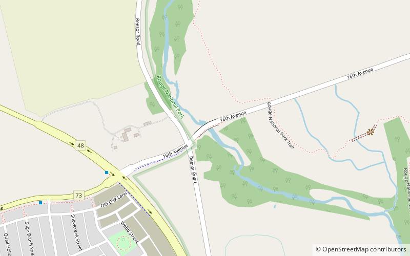
Old Bailey Bridge is a bailey bridge located below 16th Avenue east of Reesor Road within Rouge Park in Markham, Ontario, Canada. The bridge crossed the Little Rouge Creek, a tributary of the Rouge River. A new bridge was built above this bridge to provide two way access for 16th Avenue east of Ressor Road. The old bridge is in situ with ends fenced off to prevent trespassing. ()
Opened: 1945 (81 years ago)Length: 70 ftCoordinates: 43°54'8"N, 79°12'51"W
Address
Rural MarkhamMarkham
ContactAdd
Social media
Add
Getting there by public transportation
Public transportation stops near this location
- Bus
 Bus
Bus
- Calculate routeDonald Cousens Parkway / 16th Avenue 6 min walk
- Calculate route16th Avenue / Cornell Rouge Boulevard 10 min walk
- Calculate routeCornell Rouge Boulevard / White's Hill Avenue 13 min walk
- Calculate routeWhite's Hill Avenue / Cornell Rouge Boulevard 13 min walk
Day trips


Frequently Asked Questions (FAQ)
How to get to 16th Avenue Bailey Bridge by public transport?
The nearest stations to 16th Avenue Bailey Bridge:
Bus
Bus
- Donald Cousens Parkway / 16th Avenue • Lines: 25 (6 min walk)
- 16th Avenue / Cornell Rouge Boulevard • Lines: 25 (10 min walk)