Riverdale, Toronto

Gallery (4)
Map

Map
Gallery
Facts and practical information
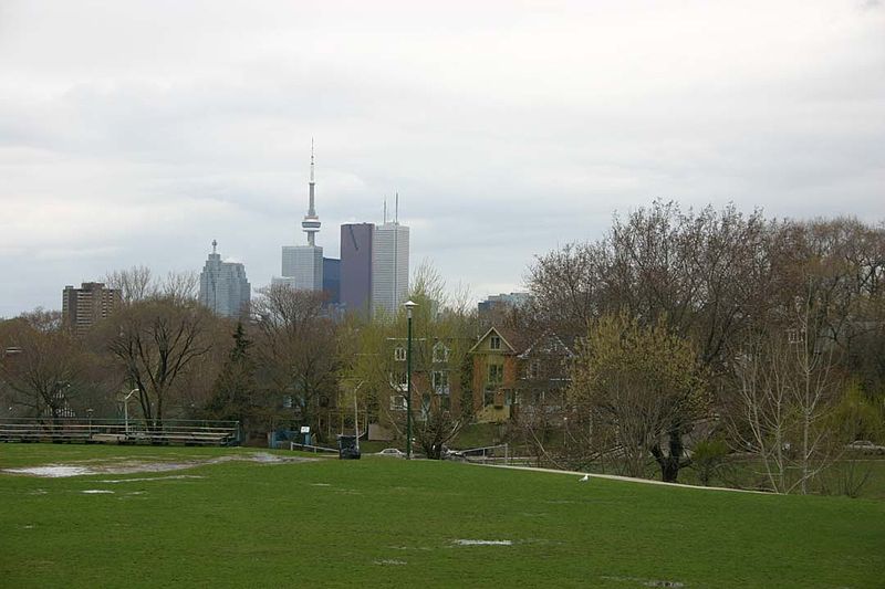
Riverdale is a large neighbourhood in Toronto, Ontario, Canada. It is bounded by the Don River Valley to the west, Danforth Avenue and Greektown to the north, Jones Avenue, the CN/GO tracks, Leslieville to the east, and Lake Shore Boulevard to the south. ()
Coordinates: 43°39'56"N, 79°21'9"W
Address
East End (Riverdale)Toronto
ContactAdd
Social media
Add
Getting there by public transportation
Public transportation stops near this location
- Metro
- Bus
- Tram
 Metro
Metro
- Calculate routeBroadview Avenue 1 min walk
- Calculate routeGerrard Street East 1 min walk
- Calculate routeJack Layton Way, Bridgepoint Health 2 min walk
- Calculate routeMount Stephen Street 3 min walk
- Calculate routeBroadview Avenue 1 min walk
- Calculate routeSt. Matthews Road 3 min walk
- Calculate routeGerrard Street East 4 min walk
- Calculate routeBlackburn Street 4 min walk
- Calculate routeBroadview 22 min walk
- Calculate routeChester 23 min walk
- Calculate routeCastle Frank 26 min walk
- Calculate routePape 28 min walk
Maps SubwayMaps
 Streetcar systemMaps
 PATH
PATH
SubwayMapsStreetcar systemMapsPATHDay trips


Frequently Asked Questions (FAQ)
Which popular attractions are close to Riverdale?
Nearby attractions include Don Jail, Toronto (3 min walk), East Chinatown, Toronto (7 min walk), Metropolitan Community Church of Toronto, Toronto (7 min walk), De Grassi Street, Toronto (9 min walk).
How to get to Riverdale by public transport?
The nearest stations to Riverdale:
Tram
Bus
Metro
Tram
- Broadview Avenue • Lines: 306, 506 (1 min walk)
- Gerrard Street East • Lines: 504B, 505 (1 min walk)
Bus
- Broadview Avenue • Lines: 121 (1 min walk)
- St. Matthews Road • Lines: 121 (3 min walk)
Metro
- Broadview • Lines: 2 (22 min walk)
- Chester • Lines: 2 (23 min walk)