Polson Pier, Toronto
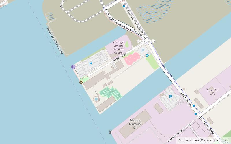
Map
Facts and practical information
Polson Pier, previously known as The Docks Waterfront Entertainment Complex, is a multi-purpose entertainment complex in Toronto, Ontario, Canada. It is located in the largely industrial Port Lands area of the city along the waterfront of Toronto Harbour. The site is also home to an amusement area, with facilities for swimming, beach volleyball, and a driving range. Until 2019, the site was also the only place in downtown Toronto to have go-karts which has since closed permanently after failing to renew its contract from the landlord and Polson Pier. ()
Coordinates: 43°38'29"N, 79°21'10"W
Address
Port LandsToronto
ContactAdd
Social media
Add
Getting there by public transportation
Public transportation stops near this location
- Bus
- Tram
- Ferry
 Bus
Bus
- Calculate routeMill Street, Distillery Loop 18 min walk
- Calculate routeFront Street East 21 min walk
- Calculate routeParliament Street 25 min walk
- Calculate routeLake Shore Boulevard East 19 min walk
- Calculate routeTrinity Street 19 min walk
- Calculate routeRichardson Street 19 min walk
- Calculate routeCherry Street 20 min walk
- Calculate routeWard's Island 19 min walk
- Calculate routeJack Layton Ferry Terminal 29 min walk
Maps SubwayMaps
 Streetcar systemMaps
 PATH
PATH
SubwayMapsStreetcar systemMapsPATHDay trips


Frequently Asked Questions (FAQ)
Which popular attractions are close to Polson Pier?
Nearby attractions include Cherry Street Strauss Trunnion Bascule Bridge, Toronto (5 min walk), 39 Commissioner Street, Toronto (10 min walk), Port of Toronto, Toronto (10 min walk), Cherry Street lift bridge, Toronto (11 min walk).
How to get to Polson Pier by public transport?
The nearest stations to Polson Pier:
Tram
Bus
Ferry
Tram
- Mill Street, Distillery Loop • Lines: 504A (18 min walk)
- Front Street East • Lines: 504A (21 min walk)
Bus
- Lake Shore Boulevard East • Lines: 75 (19 min walk)
- Trinity Street • Lines: 121 (19 min walk)
Ferry
- Ward's Island • Lines: Ward's Island (19 min walk)
- Jack Layton Ferry Terminal • Lines: Toronto Island Ferry, Ward's Island (29 min walk)