Rebel, Toronto

Facts and practical information
Rebel, located in the vibrant city of Toronto, Canada, is a premier entertainment complex that has redefined the nightlife experience for locals and tourists alike. With its sprawling 45,000 square feet of space, Rebel merges high-energy music with an immersive atmosphere, creating a multi-sensory experience for every visitor.
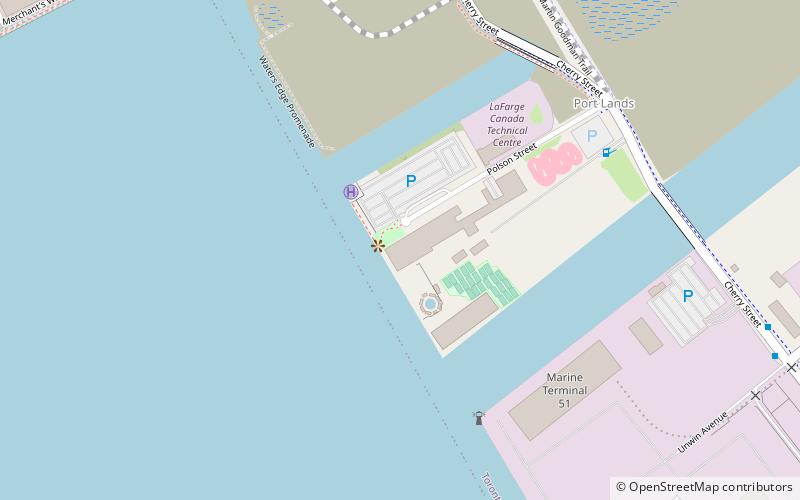
The complex, which opened its doors in September 2016, is situated on the shores of Lake Ontario, offering stunning waterfront views that add to its allure. Rebel's design is a testament to modernity, featuring state-of-the-art sound and lighting systems, as well as luxurious decor that sets the stage for an unforgettable evening.
Rebel is not just a nightclub; it is a versatile entertainment venue that hosts a variety of events including concerts, corporate events, and private parties. The complex is divided into several distinct areas, each with its own unique vibe. The Main Room is the heart of the venue, where guests can dance to the beats of renowned DJs and live performances. Meanwhile, the mezzanine level offers a more intimate setting with a spectacular view of the main stage.
The venue's commitment to providing top-tier entertainment is evident in its lineup of past performances, which includes international acts and DJs, making it a staple in Toronto's entertainment scene. Rebel's Sound Academy, a concert hall within the complex, boasts an impressive roster of artists who have graced its stage, contributing to the city's rich cultural tapestry.
Open to guests who are 19 years and older, Rebel operates on select nights of the week, drawing crowds eager to indulge in its electrifying ambiance. Whether you're looking to enjoy a night out with friends or attend a show-stopping concert, Rebel offers an unparalleled experience that captures the essence of Toronto's dynamic nightlife.
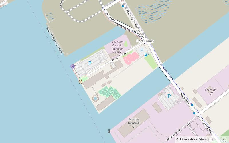
11 Polson StreetPort LandsToronto
- Metro
- Bus
- Tram
- Ferry
 Metro
Metro
- Calculate routeLake Shore Boulevard East 17 min walk
- Calculate routeRichardson Street 17 min walk
- Calculate routeTrinity Street 19 min walk
- Calculate routeLower Jarvis Street 19 min walk
- Calculate routeWard's Island 17 min walk
- Calculate routeJack Layton Ferry Terminal 26 min walk
- Calculate routeMill Street, Distillery Loop 18 min walk
- Calculate routeFront Street East 22 min walk
- Calculate routeParliament Street 24 min walk
- Calculate routeKing 33 min walk
 SubwayMaps
 Streetcar systemMaps
 PATH
PATH


Frequently Asked Questions (FAQ)
Which popular attractions are close to Rebel?
How to get to Rebel by public transport?
Bus
- Lake Shore Boulevard East • Lines: 75 (17 min walk)
- Richardson Street • Lines: 19, 75 (17 min walk)
Ferry
- Ward's Island • Lines: Ward's Island (17 min walk)
- Jack Layton Ferry Terminal • Lines: Toronto Island Ferry, Ward's Island (26 min walk)
Tram
- Mill Street, Distillery Loop • Lines: 504A (18 min walk)
- Front Street East • Lines: 504A (22 min walk)
Metro
- King • Lines: 1 (33 min walk)