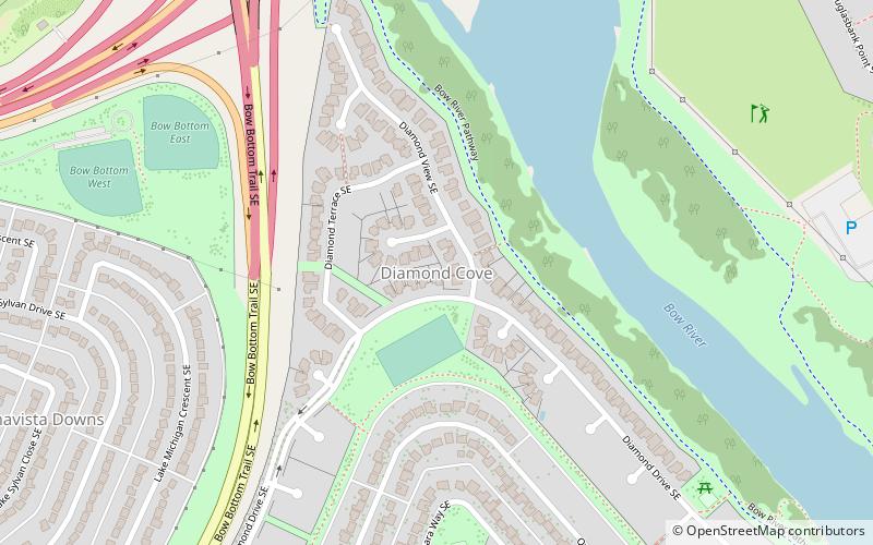
Diamond Cove, Calgary
Map
Facts and practical information
Diamond Cove is a small residential neighbourhood in the southeast quadrant of Calgary, Alberta. It is bounded to the north by Anderson Road and Deerfoot Trail, to the east by the Bow River, to the south by Queensland, and to the west by Bow Bottom Trail. ()
Area: 123.55 acres (0.1931 mi²)Coordinates: 50°56'47"N, 114°1'22"W
Address
Southeast Calgary (Queensland)Calgary
ContactAdd
Social media
Add
Getting there by public transportation
Public transportation stops near this location
- Bus
 Bus
Bus
- Calculate routeDouglas Glen 31 min walk
- Calculate routeQuarry Park 33 min walk
Day trips


Frequently Asked Questions (FAQ)
How to get to Diamond Cove by public transport?
The nearest stations to Diamond Cove:
Bus
Bus
- Douglas Glen • Lines: 306 (31 min walk)
- Quarry Park • Lines: 306 (33 min walk)