Westcliffe Estates, Ottawa
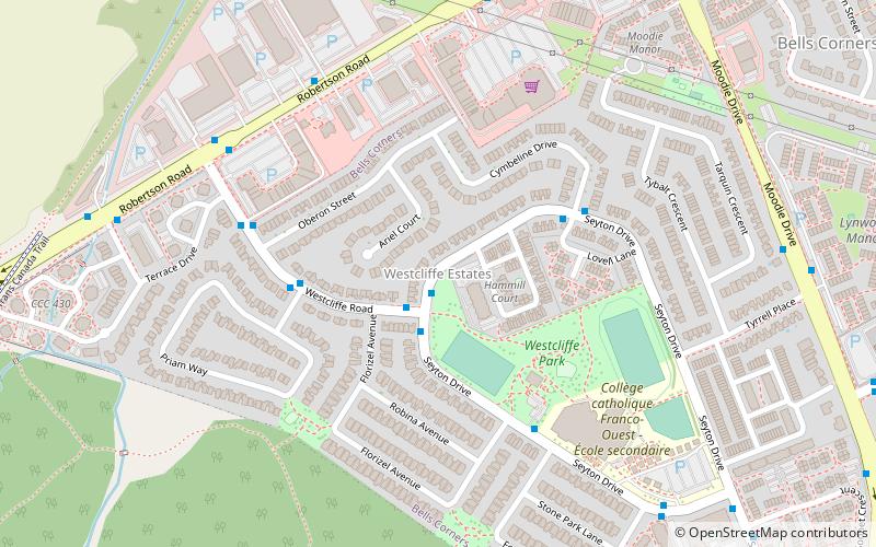
Map
Facts and practical information
Westcliffe Estates, is a neighbourhood of Bells Corners in College Ward, in the west end of Ottawa, Ontario, Canada. Founded in 1969, most of the older homes in this area were built by Assaly Construction and later the Thomas C. Assaly Corporation. The Westcliffe community is characterized by significantly higher residential densities than other parts of Bells Corners. There is a multi-storey housing complex operated by Nepean Housing as well as a multi-storey seniors residence and co-operative housing project. Today there are a total of 1760 homes in the neighbourhood. ()
Area: 0.53 mi²Coordinates: 45°19'1"N, 75°50'14"W
Address
Bell's CornerOttawa
ContactAdd
Social media
Add
Getting there by public transportation
Public transportation stops near this location
- Bus
 Bus
Bus
- Calculate routeSeyton / Westcliffe 1 min walk
- Calculate routeWestcliffe / Priam Way 4 min walk
- Calculate routeSeyton / Cymbeline 4 min walk
Day trips


Frequently Asked Questions (FAQ)
Which popular attractions are close to Westcliffe Estates?
Nearby attractions include Drummond Methodist Church, Ottawa (17 min walk), Arbeatha Park, Ottawa (18 min walk), Lynwood Village, Ottawa (20 min walk).
How to get to Westcliffe Estates by public transport?
The nearest stations to Westcliffe Estates:
Bus
Bus
- Seyton / Westcliffe • Lines: 252, 57 (1 min walk)
- Westcliffe / Priam Way • Lines: 252, 57 (4 min walk)