Centre de documentation collégiale, Montreal
Map
Facts and practical information
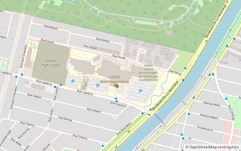
The Centre de documentation collégiale is a specialised library in education for all the post-secondary colleges and CEGEP in the province of Quebec, Canada. It is located in Montreal, Québec, Canada. ()
Coordinates: 45°26'11"N, 73°36'18"W
Address
LaSalleMontreal
ContactAdd
Social media
Add
Getting there by public transportation
Public transportation stops near this location
- Metro
- Bus
 Metro
Metro
- Calculate routeCégep André-Laurendeau 3 min walk
- Calculate routerue Lapierre / face au Cégep André-Laurendeau 3 min walk
- Calculate routeBourdeau / Lapierre 4 min walk
- Calculate routeDe La Vérendrye / Lapierre 5 min walk
- Calculate routeAngrignon 18 min walk
- Calculate routeMonk 30 min walk
Maps Metro
Metro
MetroDay trips


Frequently Asked Questions (FAQ)
Which popular attractions are close to Centre de documentation collégiale?
Nearby attractions include Angrignon Park, Montreal (11 min walk), Canal de l'Aqueduc, Montreal (13 min walk), LaSalle—Émard, Montreal (14 min walk), Des Rapides Park, Montreal (22 min walk).
How to get to Centre de documentation collégiale by public transport?
The nearest stations to Centre de documentation collégiale:
Bus
Metro
Bus
- Cégep André-Laurendeau • Lines: 113-E, 113-O, 200 Am/Pm, 90 E, 90 O (3 min walk)
- rue Lapierre / face au Cégep André-Laurendeau • Lines: 111 E, 111 O, 200 Pm (3 min walk)
Metro
- Angrignon • Lines: 1 (18 min walk)
- Monk • Lines: 1 (30 min walk)