Elbow Park, Calgary
Map
Facts and practical information
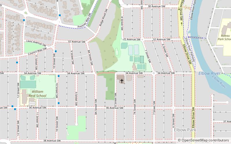
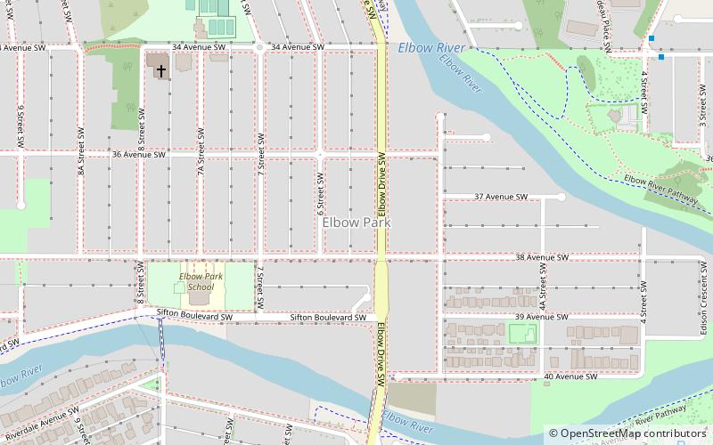
Elbow Park is an affluent residential neighbourhood in the southwest quadrant of Calgary, Alberta. It is one of the oldest and wealthiest communities in the city. It is bordered to the south and east by Elbow River, to the east by Elbow Drive, to the north by Council Way and to the west by 14 Street W. ()
Area: 197.68 acres (0.3089 mi²)Coordinates: 51°1'24"N, 114°5'1"W
Getting there by public transportation
Public transportation stops near this location
- Bus
- Light rail
 Bus
Bus
- Calculate route10 Street & 34 Avenue SW 5 min walk
- Calculate route39 Avenue 27 min walk
- Calculate routeErlton/Stampede 31 min walk
- Calculate routeVictoria Park/Stampede 39 min walk
Day trips


Frequently Asked Questions (FAQ)
Which popular attractions are close to Elbow Park?
Nearby attractions include Calgary-Elbow, Calgary (8 min walk), Britannia, Calgary (19 min walk), Parkhill/Stanley Park, Calgary (21 min walk), cSPACE, Calgary (21 min walk).
How to get to Elbow Park by public transport?
The nearest stations to Elbow Park:
Bus
Light rail
Bus
- 10 Street & 34 Avenue SW • Lines: 13 (5 min walk)
Light rail
- 39 Avenue • Lines: 201 (27 min walk)
- Erlton/Stampede • Lines: 201 (31 min walk)