Harvest Hills, Calgary
Map
Facts and practical information
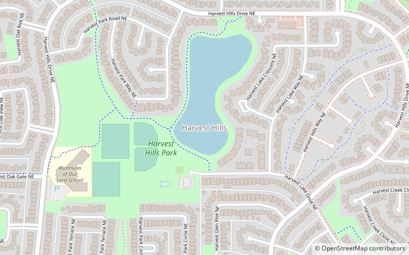
Harvest Hills is a residential neighbourhood in the northeast quadrant of Calgary, Alberta. It is bounded by Deerfoot Trail to the east, by Beddington Trail to the south, by Country Hills Boulevard to the north and by Harvest Hills Boulevard to the west. The community contains a lake. The Harvest Hills golf course, shut down in early 2016 with demolition planned for late 2016 and early 2017, is in the process of redevelopment to add additional housing options in the northeast corner of the community. ()
Area: 0.85 mi²Coordinates: 51°8'54"N, 114°3'14"W
Getting there by public transportation
Public transportation stops near this location
- Bus
 Bus
Bus
- Calculate routeEB 96 AV NE @ Harvest Hills LI 13 min walk
- Calculate routeWB 96 AV NE @ Harvest Rose PA 16 min walk
Day trips


Frequently Asked Questions (FAQ)
How to get to Harvest Hills by public transport?
The nearest stations to Harvest Hills:
Bus
Bus
- EB 96 AV NE @ Harvest Hills LI • Lines: 300 (13 min walk)
- WB 96 AV NE @ Harvest Rose PA • Lines: 300 (16 min walk)