The Brass Rail, Toronto
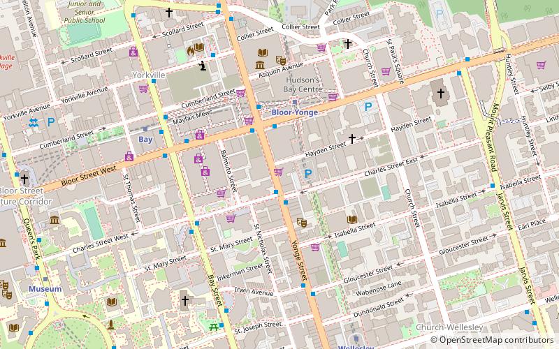
Map
Facts and practical information
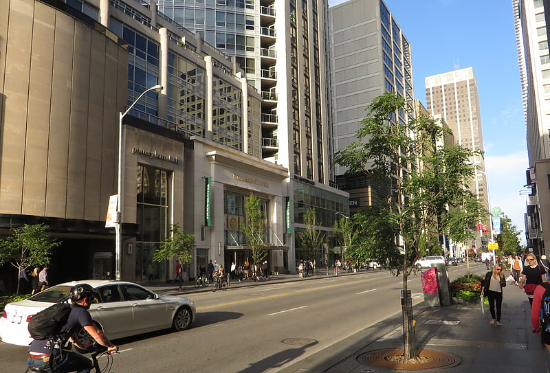
The Brass Rail is one of Toronto's downtown strip clubs. It is located on Yonge Street just south of Bloor. It is well known as a popular venue for celebrities, especially during the Toronto International Film Festival, which is based at the nearby luxury hotels of Yorkville. Stars that have been observed there include Samuel L. Jackson, Charlize Theron, Alex Rodriguez, and Colin Farrell. The Brass Rail was one of the first venues Paul Shaffer worked in, serving as host and musician. ()
Coordinates: 43°40'9"N, 79°23'10"W
Address
Downtown Toronto (Church and Wellesley)Toronto
ContactAdd
Social media
Add
Getting there by public transportation
Public transportation stops near this location
- Metro
- Bus
- Tram
 Metro
Metro
- Calculate routeBloor-Yonge 3 min walk
- Calculate routeBay 6 min walk
- Calculate routeWellesley 8 min walk
- Calculate routeMuseum 11 min walk
- Calculate routeCharles Street West 4 min walk
- Calculate routeBloor Street West 6 min walk
- Calculate routeSt. Joseph Street 6 min walk
- Calculate routeYonge Street 15 min walk
- Calculate routeBay Street 15 min walk
- Calculate routeElizabeth Street 16 min walk
Maps SubwayMaps
 Streetcar systemMaps
 PATH
PATH
SubwayMapsStreetcar systemMapsPATHDay trips
The Brass Rail – popular in the area (distance from the attraction)
Nearby attractions include: Mink Mile, Manulife Centre, Philosopher's Walk, Yorkville Village.


Frequently Asked Questions (FAQ)
Which popular attractions are close to The Brass Rail?
Nearby attractions include The One, Toronto (2 min walk), The Silver Dollar Room, Toronto (2 min walk), Casa Condominio Residenza, Toronto (3 min walk), Panasonic Theatre, Toronto (3 min walk).
How to get to The Brass Rail by public transport?
The nearest stations to The Brass Rail:
Metro
Bus
Tram
Metro
- Bloor-Yonge • Lines: 1, 2 (3 min walk)
- Bay • Lines: 2 (6 min walk)
Bus
- Charles Street West • Lines: 19 (4 min walk)
- Bloor Street West • Lines: 19 (6 min walk)
Tram
- Yonge Street • Lines: 306, 506 (15 min walk)
- Bay Street • Lines: 306, 506 (15 min walk)