Libuš, Prague

Gallery (1)
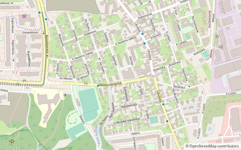
Map
Map
Facts and practical information
Libuš is one of the municipal districts of Prague. It is located in the southern part of Prague in the administrative district of Prague 4 and consists of the cadastral areas of Libuš and Písnice. ()
Address
Praha 12 (Praha-Libuš)Prague
ContactAdd
Social media
Add
Getting there by public transportation
Public transportation stops near this location
- Bus
- Tram
 Bus
Bus
- Calculate routeJirčanská 3 min walk
- Calculate routeLibuš 4 min walk
- Calculate routeU Libušské sokolovny 5 min walk
- Calculate routeU Zvoničky 8 min walk
- Calculate routeLevského 29 min walk
Maps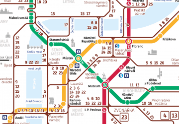 Metro / Trams
Metro / TramsDay trips


Frequently Asked Questions (FAQ)
How to get to Libuš by public transport?
The nearest stations to Libuš:
Bus
Tram
Bus
- Jirčanská • Lines: 165, 197, 904 (3 min walk)
- Libuš • Lines: 113, 165, 331, 333, 913 (4 min walk)
Tram
- Levského • Lines: 17, 21, 3, 92 (29 min walk)