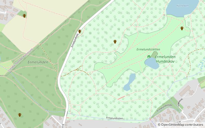
Ermelunden, Skodsborg
Map
Facts and practical information
Ermelunden is a small forest in Gentofte, Denmark. It is adjacent to the larger Jægersborg Dyrehave. ()
Area: 172.97 acres (0.2703 mi²)Coordinates: 55°46'12"N, 12°32'20"E
Address
Northern Suburbs (Charlottenlund)Skodsborg
ContactAdd
Social media
Add
Getting there by public transportation
Public transportation stops near this location
- Bus
- Light rail
 Bus
Bus
- Calculate routeErmelundsvej 7 min walk
- Calculate routeHjortekærsvej 8 min walk
- Calculate routeVed Fortunen 10 min walk
- Calculate routeHvidegårdsparken 13 min walk
- Calculate routeJægersborg 23 min walk
- Calculate routeNørgaardsvej 26 min walk
- Calculate routeGentofte 29 min walk
Day trips


Frequently Asked Questions (FAQ)
Which popular attractions are close to Ermelunden?
Nearby attractions include Garderhøjfortet, Copenhagen (14 min walk), Jægersborg Allé, Skodsborg (19 min walk), Jægersborg Water Tower, Copenhagen (24 min walk).
How to get to Ermelunden by public transport?
The nearest stations to Ermelunden:
Bus
Light rail
Bus
- Ermelundsvej • Lines: 388 (7 min walk)
- Hjortekærsvej • Lines: 388 (8 min walk)
Light rail
- Jægersborg • Lines: 910, A, E (23 min walk)
- Nørgaardsvej • Lines: 910 (26 min walk)