Pirkkola, Helsinki
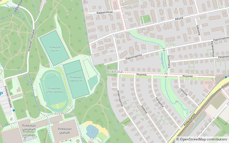
Map
Facts and practical information
Address
Pohjoinen (Maunula)Helsinki
ContactAdd
Social media
Add
Getting there by public transportation
Public transportation stops near this location
- Bus
- Train
 Bus
Bus
- Calculate routePirkkola 7 min walk
- Calculate routeNiittyluhdantie 9 min walk
- Calculate routeAlkutie 12 min walk
- Calculate routePirjontie 12 min walk
- Calculate routePohjois-Haaga 31 min walk
- Calculate routeHuopalahti 36 min walk
- Calculate routeKäpylä 36 min walk
Day trips


Frequently Asked Questions (FAQ)
Which popular attractions are close to Pirkkola?
Nearby attractions include Central Park, Helsinki (20 min walk), Maunulanpuisto, Helsinki (20 min walk).
How to get to Pirkkola by public transport?
The nearest stations to Pirkkola:
Bus
Train
Bus
- Pirkkola • Lines: 550 (7 min walk)
- Niittyluhdantie • Lines: 54, 553, 553K (9 min walk)
Train
- Pohjois-Haaga (31 min walk)
- Huopalahti (36 min walk)