Mairie du Mans, Le Mans

Facts and practical information
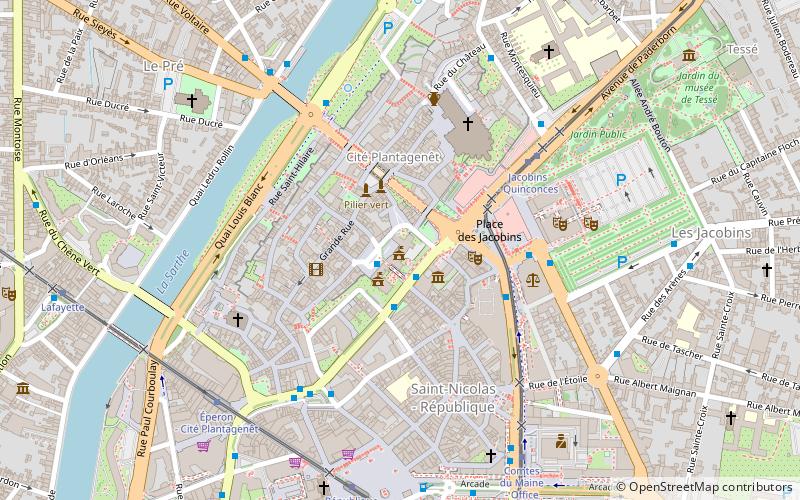
Mairie du Mans (address: place saint Pierre) is a place located in Le Mans (Pays de la Loire region) and belongs to the category of city hall.
It is situated at an altitude of 246 feet, and its geographical coordinates are 48°0'27"N latitude and 0°11'50"E longitude.
Planning a visit to this place, one can easily and conveniently get there by public transportation. Mairie du Mans is a short distance from the following public transport stations: Cité Plantagenêt (bus, 1 min walk), Jacobins - Quinconces (tram, 5 min walk), Le Mans Gare Sud (train, 24 min walk).
Among other places and attractions worth visiting in the area are: Enceinte romaine (city wall, 3 min walk), Le Mans Cathedral (church, 4 min walk), Church of St. Benedict (church, 5 min walk).
- Bus
- Tram
- Train
 Bus
Bus
- Calculate routeCité Plantagenêt 1 min walk
- Calculate routeMairie 2 min walk
- Calculate routeMendès France 4 min walk
- Calculate routeJacobins 4 min walk
- Calculate routeJacobins - Quinconces 5 min walk
- Calculate routeÉperon - Cité Plantagenêt 7 min walk
- Calculate routeComtes du Maine - Office de tourisme 7 min walk
- Calculate routeRépublique 7 min walk
- Calculate routeLe Mans Gare Sud 24 min walk


Frequently Asked Questions (FAQ)
Which popular attractions are close to Mairie du Mans?
How to get to Mairie du Mans by public transport?
Bus
- Cité Plantagenêt • Lines: Mancelle (1 min walk)
- Mairie • Lines: 11, 12, 14, 17, 20, 4, 7, Mancelle (2 min walk)
Tram
- Jacobins - Quinconces • Lines: T2 (5 min walk)
- Éperon - Cité Plantagenêt • Lines: T1 (7 min walk)
Train
- Le Mans Gare Sud (24 min walk)