Pic de Bertagne
Map

Gallery

Facts and practical information
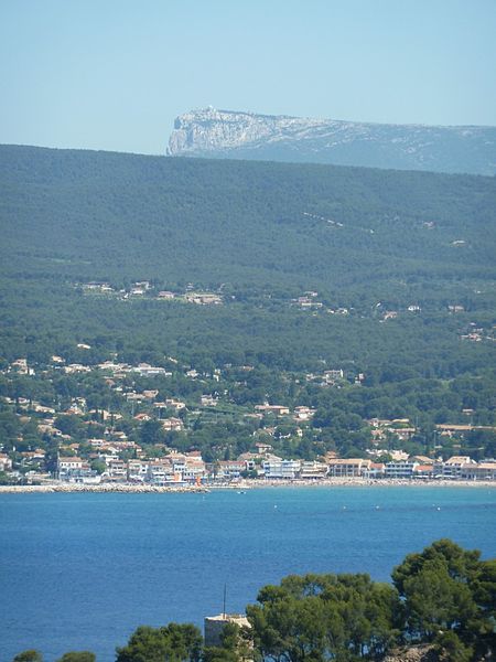
The peak of Bertagne is the highest point of the Bouches-du-Rhône. The summit culminates at 1 042 m of altitude. It is part of the Sainte-Baume massif.
It is visible in a large part of the south of the departments of Bouches-du-Rhône and Var. It is located in the commune of Gémenos.
A paved road climbs the crest of the massif and makes it possible to climb the Bertagne peak by bike. It stops in front of a civil aviation radar zone at about 1,020 m altitude.
Coordinates: 43°18'42"N, 5°41'16"E
Location
Provence-Alpes-Côte d'Azur
ContactAdd
Social media
Add
Day trips
Pic de Bertagne – popular in the area (distance from the attraction)
Nearby attractions include: St. John the Baptist Church, Sainte-Baume, Town Hall, Circuit Paul Ricard.


