Pic Long, Pyrénées National Park
#18 among attractions in Pyrénées National Park
![Pic Long location map](https://tzmedia.b-cdn.net/media/images/static-maps/fr/42_8008_0_10013.jpg)
Facts and practical information
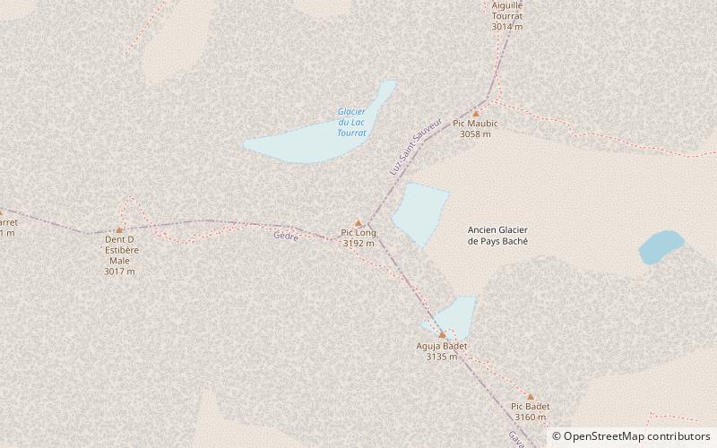
Pic Long is the highest mountain in the Néouvielle massif in the Pyrenees. ()
Pyrénées National Park France
Pic Long – popular in the area (distance from the attraction)
Nearby attractions include: Château de Sainte-Marie, Pic de Néouvielle, Lac d'Aumar, Lac de l'Oule.
7.2 miNWRuinsChâteau de Sainte-Marie, Luz-Saint-Sauveur
184 min walk • The Château de Sainte-Marie is a ruined castle in the commune of Esterre in the Hautes-Pyrénées département of France.
2.5 miNSoaring peak with granite and glaciersPic de Néouvielle, Néouvielle National Nature Reserve
64 min walk • Pic de Néouvielle is a mountain in the Néouvielle massif in the French Pyrenees. It is located in the commune of Saint-Lary-Soulan within the department of the Hautes-Pyrénées, and lies on the border between the Pyrenees National Park and the Néouvielle National Nature Reserve.
3.8 miNENature, Natural attraction, LakeLac d'Aumar, Néouvielle National Nature Reserve
97 min walk • Lac d'Aumar is a lake in Hautes-Pyrénées, France. At an elevation of 2192 m, its surface area is 0.25 km².
5.5 miNENature, Natural attraction, LakeLac de l'Oule
142 min walk • Lac de l'Oule is a lake in Hautes-Pyrénées, France. At an elevation of 1819 m, its surface area is 58 ha.
3.6 miNENature, Natural attraction, LakeLac d'Orédon, Aragnouet
92 min walk • Lac d'Orédon is a lake raised by a dam in Hautes-Pyrénées, France. At an elevation of 1849 m, its surface area is 0.46 km². It was one of the first lakes of the Pyrenees to have been built in the 17th century.
1.2 miSENature, Natural attraction, MountainCampbieil, Pyrénées National Park
30 min walk • The Campbieil is a summit in the French Pyrenees, culminating at a height of 3,173 m. It is located in the Néouvielle massif, included in the Pyrenees National Park of which it constitutes the second highest summit, after the pic Long.
5.1 miNENature, Natural attraction, LakeLac de Madamète
130 min walk • Lac de Madamète is a lake in Hautes-Pyrénées, France. At an elevation of 2299 m, its surface area is 0.026 km².
3.5 miNENature, Natural attraction, LakeLac d'Aubert, Néouvielle National Nature Reserve
90 min walk • Lac d'Aubert is a lake in Hautes-Pyrénées, France. At an elevation of 2148 m, its surface area is 0.45 km².
2.2 miNNature, Natural attraction, MountainTrois Conseillers, Pyrénées National Park
56 min walk • The Trois Conseillers is a summit in the French Pyrenees, culminating at 3,039 metres.
2.6 miNEScenic mountain climbing destinationPic Ramougn, Néouvielle National Nature Reserve
66 min walk • Pic Ramougn is a steep, rocky mountain in the Néouvielle massif in the Pyrenees. It is located in the commune of Saint-Lary-Soulan within the department of the Hautes-Pyrénées, and is named after the French politician, geologist and botanist Louis Ramond de Carbonnières.
1.5 miENature, Natural attraction, MountainEstaragne, Pyrénées National Park
40 min walk • The Estaragne is a French pyrenean summit, culminating at 3,006 m m.