Dolphin's Nose, Visakhapatnam

Gallery (1)
Map

Map
Facts and practical information
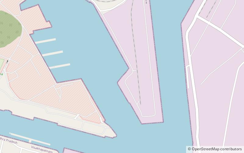
Dolphin's Nose is a hill in Visakhapatnam between Yarada and Gangavaram Port. The hill is named Dolphin's Nose because it resembles a dolphin's nose. It is a conspicuous land mark in Visakhapatnam. Dolphin's nose is a huge rocky head land which is 174 meters high and 358 meters above sea level. The powerful beacon of the light house set on this rock at sea directs ships 65 km away. ()
Elevation: 1175 ftCoordinates: 17°39'58"N, 83°14'36"E
Address
Visakhapatnam
ContactAdd
Social media
Add
Getting there by public transportation
Public transportation stops near this location
- Bus
 Bus
Bus
- Calculate routeJanata Colony Bus Stop 30 min walk
Day trips


Frequently Asked Questions (FAQ)
How to get to Dolphin's Nose by public transport?
The nearest stations to Dolphin's Nose:
Bus
Bus
- Janata Colony Bus Stop (30 min walk)