Cooke Town, Bangalore
Facts and practical information
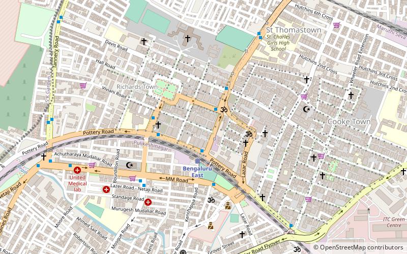
Cooke Town is a neighbourhood in Bangalore Cantonment, in Bangalore North-East, India. Built as a suburb before Indian Independence, it is one of Bangalore's oldest neighbourhoods, established when the Bangalore Civil and Military Station was governed by the Madras Government. Cooke Town is named after G H Cooke, President of the Bangalore Civil and Military Station Municipality between 1928 and 1934, with the Mayo Hall being constructed during his tenure. The suburb, along with other suburbs of the Bangalore Cantonment such as Fraser Town, Cox Town, Richmond Town, and Langford Town, has seen dynamic changes over last few years with large British Raj era bungalows being demolished to build luxury apartments. These developments have resulted in large scale tree-felling. However, Cooke Town still manages to retain some of its colonial charm, and is called the nicest place in the Cantonment by Bangalore historian Peter Colaco. Cooke Town is a posh neighbourhood with plenty of greenery, parks, educational institutions, hospitals and is at close proximity to the Bangalore East Railway Station and the Bangalore CBD. According to Colliers International, Cooke Town is one of Bangalore's most costliest neighbourhoods, with the cost of property being in the range to INR 70000-75000 per sq.ft, just slightly lesser than the Bangalore CBD. ()
SagayapuraBangalore
- Bus
- Train
 Bus
Bus
- Calculate routeBengaluru East 3 min walk
- Calculate routeBanaswadi 18 min walk
- Calculate routeDavis Road 4 min walk
- Calculate routeClarence School 4 min walk
- Calculate routeMosque Road 7 min walk
- Calculate routeCharles School 8 min walk


Frequently Asked Questions (FAQ)
Which popular attractions are close to Cooke Town?
How to get to Cooke Town by public transport?
Train
- Bengaluru East (3 min walk)
- Banaswadi (18 min walk)
Bus
- Davis Road • Lines: 292, 292B, 293C, 293E, 294B (4 min walk)
- Clarence School • Lines: 292, 292B, 293C, 293E, 294B, 300E, 302, 302G, 303F (4 min walk)