Broaghnabinnia
#410 among destinations in Ireland

Facts and practical information
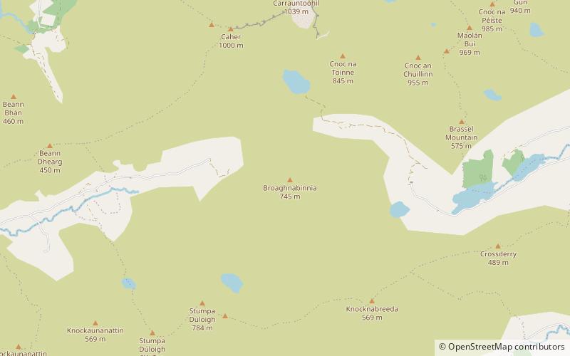
Broaghnabinnia is a summit of the Dunkerron Mountains, part of the Mountains of the Iveragh Peninsula in County Kerry, Ireland. ()
KerryIreland
Broaghnabinnia – popular in the area (distance from the attraction)
Nearby attractions include: Carrauntoohil, Beenkeragh, Purple Mountain, Cnoc na Péiste.
 Natural attraction, Park, Mountain
Carrauntoohil, Killarney
48 min walk • Carrauntoohil stands as the tallest peak in Ireland, dominating the skyline at an impressive height of 1,038 meters (3,406 feet). Located in the heart of County Kerry, near the scenic town of Killarney, this mountain is the central attraction of the MacGillycuddy's...
 Nature, Natural attraction, Mountain
Beenkeragh
61 min walk • Beenkeragh or Benkeeragh is the second-highest peak in Ireland, at 1,008.2 metres, on both the Arderin and Vandeleur-Lynam lists. It is part of the MacGillycuddy's Reeks range in County Kerry.
 Purple-hued peak for challenging hikes
Purple Mountain, Killarney National Park
148 min walk • Purple Mountain at 832 metres high, is the 21st–highest peak in Ireland on the Arderin scale, and the 28th–highest according to the Vandeleur-Lynam scale. It is located in County Kerry, and is the highest point of the Purple Mountain Group.
 Nature, Natural attraction, Mountain
Cnoc na Péiste
71 min walk • Cnoc na Péiste, anglicised Knocknapeasta, at 988 metres, is the fourth-highest peak in Ireland, on the Arderin and Vandeleur-Lynam lists. Cnoc na Péiste is part of the MacGillycuddy's Reeks range in County Kerry.
 Nature, Natural attraction, Mountain
Caher
42 min walk • Caher or Caher East Top at 1,000 metres, is the third-highest peak in Ireland, on the Irish Arderin and Vandeleur-Lynam classifications. It is part of the MacGillycuddy's Reeks in County Kerry.
 Nature, Natural attraction, Mountain
The Bones
52 min walk • The Bones, at 957 metres high, is the seventh-highest peak in Ireland on the Arderin list, or the eighth-highest according to the Vandeleur-Lynam list.
 Nature, Natural attraction, Mountain
The Big Gun
80 min walk • The Big Gun, at 939 metres high, is the ninth-highest peak in Ireland on the Arderin list, or the tenth-highest according to the Vandeleur-Lynam list.
 Nature, Natural attraction, Lake
Lough Acoose
94 min walk • Lough Acoose is a freshwater lake in the southwest of Ireland. It is located on the Iveragh Peninsula of County Kerry near the MacGillycuddy's Reeks mountains.
 Nature, Natural attraction, Mountain
Maolán Buí
63 min walk • Maolán Buí, also known by the name Bearna Rua, at 973 metres high, is the fifth-highest peak in Ireland on the Arderin list, or the sixth-highest peak in Ireland according to the Vandeleur-Lynam list. Maolán Buí is also known for its narrow north-west spur, called The Bone. It is part of the MacGillycuddy's Reeks in Kerry.
 Nature, Natural attraction, Mountain
Stumpa Dúloigh
39 min walk • Stumpa Dúloigh also known as Maol, is the highest of the Dunkerron Mountains, part of the Mountains of the Iveragh Peninsula in County Kerry, Ireland. It has a height of 784 metres and lies southwest of MacGillycuddy's Reeks.
 Nature, Natural attraction, Mountain pass
Moll's Gap, Killarney
113 min walk • Moll's Gap or Céim an Daimh, is a mountain pass on the N71 road from Kenmare to Killarney in Kerry, Ireland. Moll's Gap is on the Ring of Kerry route, and offers views of the MacGillycuddy's Reeks mountains, and is a popular tourist location.


