Stumpa Dúloigh
#262 among destinations in Ireland
![Stumpa Dúloigh location map](https://tzmedia.b-cdn.net/media/images/static-maps/ie/51_9539_-9_76507.jpg)
Facts and practical information
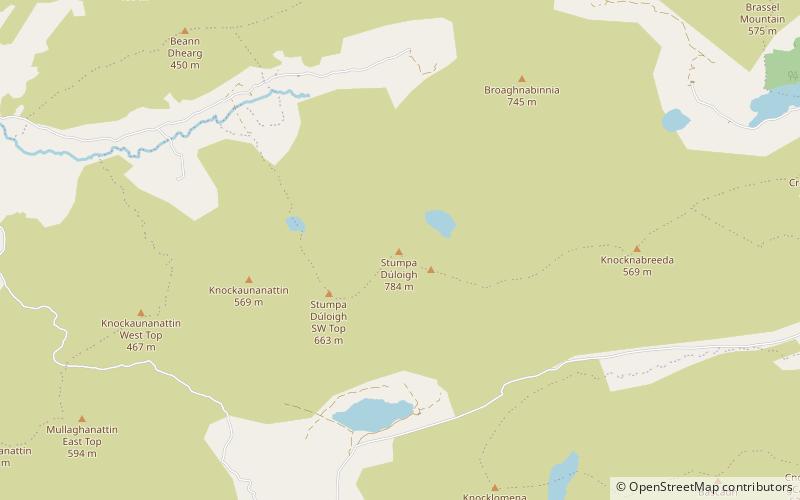
Stumpa Dúloigh also known as Maol, is the highest of the Dunkerron Mountains, part of the Mountains of the Iveragh Peninsula in County Kerry, Ireland. It has a height of 784 metres and lies southwest of MacGillycuddy's Reeks. ()
KerryIreland
Stumpa Dúloigh plan & book
Unleash the traveler in you — discover the cheapest flight deals, find the perfect hotel or hostel nearby, and search for the best car rental prices. Travel at your own pace to discover new places and enjoy your journey.
Stumpa Dúloigh – popular in the area (distance from the attraction)
Nearby attractions include: Carrauntoohil, Beenkeragh, Cnoc na Péiste, Caher.
3.3 miNNatural attraction, Park, MountainCarrauntoohil, Killarney
84 min walk • Carrauntoohil stands as the tallest peak in Ireland, dominating the skyline at an impressive height of 1,038 meters (3,406 feet). Located in the heart of County Kerry, near the scenic town of Killarney, this mountain is the central attraction of the MacGillycuddy's...
3.7 miNNature, Natural attraction, MountainBeenkeragh
96 min walk • Beenkeragh or Benkeeragh is the second-highest peak in Ireland, at 1,008.2 metres, on both the Arderin and Vandeleur-Lynam lists. It is part of the MacGillycuddy's Reeks range in County Kerry.
4.2 miNENature, Natural attraction, MountainCnoc na Péiste
108 min walk • Cnoc na Péiste, anglicised Knocknapeasta, at 988 metres, is the fourth-highest peak in Ireland, on the Arderin and Vandeleur-Lynam lists. Cnoc na Péiste is part of the MacGillycuddy's Reeks range in County Kerry.
2.8 miNNature, Natural attraction, MountainCaher
72 min walk • Caher or Caher East Top at 1,000 metres, is the third-highest peak in Ireland, on the Irish Arderin and Vandeleur-Lynam classifications. It is part of the MacGillycuddy's Reeks in County Kerry.
3.4 miNNature, Natural attraction, MountainThe Bones
87 min walk • The Bones, at 957 metres high, is the seventh-highest peak in Ireland on the Arderin list, or the eighth-highest according to the Vandeleur-Lynam list.
4.6 miNENature, Natural attraction, MountainThe Big Gun
118 min walk • The Big Gun, at 939 metres high, is the ninth-highest peak in Ireland on the Arderin list, or the tenth-highest according to the Vandeleur-Lynam list.
4.1 miNWNature, Natural attraction, LakeLough Acoose
105 min walk • Lough Acoose is a freshwater lake in the southwest of Ireland. It is located on the Iveragh Peninsula of County Kerry near the MacGillycuddy's Reeks mountains.
3.9 miNENature, Natural attraction, MountainMaolán Buí
100 min walk • Maolán Buí, also known by the name Bearna Rua, at 973 metres high, is the fifth-highest peak in Ireland on the Arderin list, or the sixth-highest peak in Ireland according to the Vandeleur-Lynam list. Maolán Buí is also known for its narrow north-west spur, called The Bone. It is part of the MacGillycuddy's Reeks in Kerry.
4.7 miENature, Natural attraction, Mountain passMoll's Gap, Killarney
121 min walk • Moll's Gap or Céim an Daimh, is a mountain pass on the N71 road from Kenmare to Killarney in Kerry, Ireland. Moll's Gap is on the Ring of Kerry route, and offers views of the MacGillycuddy's Reeks mountains, and is a popular tourist location.
3.2 miNENature, Natural attraction, MountainBrassel Mountain
82 min walk • Brassel Mountain at 575 metres, is the 261-st highest peak in Ireland, on the Arderin scale. It is part of the MacGillycuddy's Reeks range in County Kerry.
3.3 miNENature, Natural attraction, MountainCnoc an Chuillin
85 min walk • Cnoc an Chuillinn, at 958 metres, is the sixth-highest peak in Ireland on the Arderin list and the seventh-highest peak in Ireland on the Vandeleur-Lynam list.