Castleruddery Stone Circle
#698 among destinations in Ireland
Facts and practical information
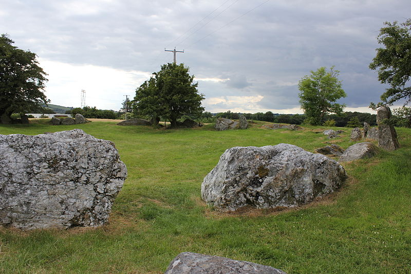
Castleruddery Stone Circle is a recumbent stone circle and National Monument located in County Wicklow, Ireland. ()
WicklowIreland
Castleruddery Stone Circle plan & book
Unleash the traveler in you — discover the cheapest flight deals, find the perfect hotel or hostel nearby, and search for the best car rental prices. Travel at your own pace to discover new places and enjoy your journey.
Castleruddery Stone Circle – popular in the area (distance from the attraction)
Nearby attractions include: Keadeen Mountain, Baltinglass Abbey, Rathcoran, Dwyer–McAllister Cottage.
- 3.6 miSENature, Natural attraction, Mountain
Keadeen Mountain
92 min walk • Keadeen Mountain at 653 metres, is the 152nd–highest peak in Ireland on the Arderin scale, and the 184th–highest peak on the Vandeleur-Lynam scale.
- 4.6 miSWArchaeological site
Baltinglass Abbey
117 min walk • Baltinglass Abbey is a former Cistercian abbey founded in 1148 and located in Baltinglass, Ireland. It is today a National Monument.
- 3.6 miSWArchaeological site
Rathcoran
92 min walk • Rathcoran is a passage grave and hillfort and National Monument located atop Baltinglass Hill, County Wicklow, Ireland.
- 3.6 miSEMuseum
Dwyer–McAllister Cottage
92 min walk • The Dwyer–McAllister Cottage is a thatched cottage and National Monument located in the Glen of Imaal, County Wicklow, Ireland.
- 4.8 miNENature, Natural attraction, Mountain
Church Mountain
123 min walk • Church Mountain, also called Slieve Gad, is the westernmost of the Wicklow Mountains in Ireland. It is 544 metres high. At the summit are the remains of a large ancient cairn of pagan origin.
- 3.5 miNENature, Natural attraction, Mountain
Sugarloaf
91 min walk • Sugarloaf is a 552 metres peak in west Wicklow, Ireland that lies on the northern edge of the Glen of Imaal. With a prominence of only 14 metres, it is not listed in any of the recognised categories of mountains in Ireland, and is a subsidiary summit of Lobawn 636 metres, to the north.
- 5.7 miNMemorial
Piper's Stones
145 min walk • The Piper's Stones or the Athgreany stone circle is a Bronze Age stone circle at Athgreany, County Wicklow. It sits on a low hillock overlooking the N81, 2 km south of Hollywood.
- 4.5 miNENature, Natural attraction, Mountain
Lobawn
115 min walk • Lobawn at 636 metres, is the 182nd–highest peak in Ireland on the Arderin scale, and the 219th–highest peak on the Vandeleur-Lynam scale. Lobawn has a flat boggy summit plateau with a "war department" concrete post to mark the top.
- 4.6 miNWArchaeological site
Tornant Moat, Dunlavin
118 min walk • Tornant Moat is an Irish National Monument composed of a ringfort and nearby barrows.
- 3.4 miSArchaeological site
Crossoona Rath
86 min walk • Crossoona Rath is a ringfort located in County Wicklow, Ireland. Together with a nearby ogham stone, it forms a National Monument.
- 4.5 miSWTown
Baltinglass
116 min walk • One of the town's most iconic landmarks is the Baltinglass Abbey, a 12th-century Cistercian monastery that boasts stunning architectural features and a rich history. Visitors can wander through the ruins of the abbey, marvel at its intricate stone carvings, and imagine...