Silsean, Wicklow Mountains National Park

Gallery (1)
Map
Map
Facts and practical information
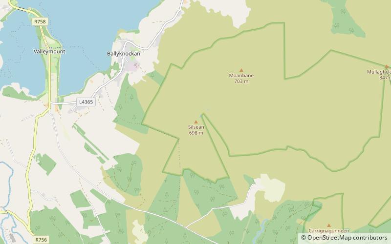
Silsean at 698 metres, is the 92nd–highest peak in Ireland on the Arderin scale, and the 114th–highest peak on the Vandeleur-Lynam scale. Silsean is in the central sector, at the western edge, of the Wicklow Mountains, in Wicklow, Ireland. Silsean is on a small massif alongside Moanbane 703 metres which lies between the Blessington lakes, and the major massif of Mullaghcleevaun 849 metres. ()
Elevation: 2290 ftProminence: 141 ftCoordinates: 53°5'31"N, 6°28'25"W
Address
Wicklow Mountains National Park
ContactAdd
Social media
Add
Day trips


