Herzog Park, Dublin
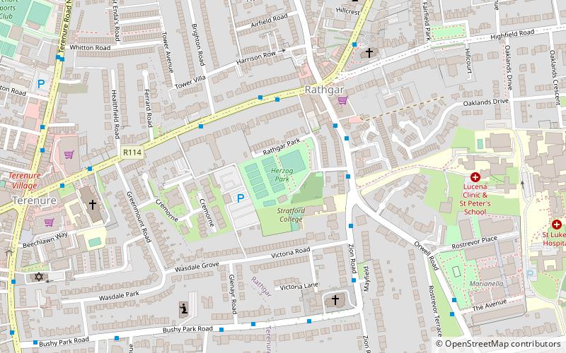
Map
Facts and practical information
Herzog Park is a park located in Rathgar, Dublin. ()
Elevation: 148 ft a.s.l.Coordinates: 53°18'37"N, 6°16'33"W
Address
Orwell MewsSouthside (Rathmines)Dublin
ContactAdd
Social media
Add
Getting there by public transportation
Public transportation stops near this location
- Bus
- Tram
 Bus
Bus
- Calculate routeTerenure Road North 8 min walk
- Calculate routeTerenure Road, Fergus Rd 10 min walk
- Calculate routeRathfarnham Road, War Memorial Hall 10 min walk
- Calculate routeMilltown 26 min walk
- Calculate routeCowper 26 min walk
- Calculate routeBeechwood 29 min walk
- Calculate routeWindy Arbour 31 min walk
Day trips


Frequently Asked Questions (FAQ)
Which popular attractions are close to Herzog Park?
Nearby attractions include Rathgar, Dublin (3 min walk), Orwell Healthcare, Dublin (13 min walk), Kenilworth Square, Dublin (15 min walk), Trinity Hall, Dublin (17 min walk).
How to get to Herzog Park by public transport?
The nearest stations to Herzog Park:
Bus
Tram
Bus
- Terenure Road North • Lines: 49 (8 min walk)
- Terenure Road, Fergus Rd • Lines: 16, 17, 17D (10 min walk)
Tram
- Milltown • Lines: Luas Green Line (26 min walk)
- Cowper • Lines: Luas Green Line (26 min walk)