Pa'ar Cave
#92 among destinations in Israel

Facts and practical information
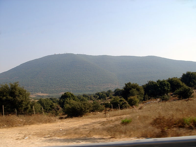
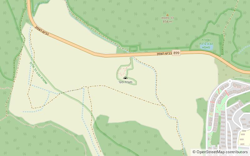
Pa'ar Cave is a karstic sinkhole in the Upper Galilee, Israel. ()
HaZafonIsrael
Pa'ar Cave plan & book
Unleash the traveler in you — discover the cheapest flight deals, find the perfect hotel or hostel nearby, and search for the best car rental prices. Travel at your own pace to discover new places and enjoy your journey.
Pa'ar Cave – popular in the area (distance from the attraction)
Nearby attractions include: Mount Meron, Jish, Peki'in Synagogue, Bar'am National Park.
 Nature, Natural attraction, Lookout
Mount Meron, Upper Galilee
72 min walk • Mount Meron is a mountain in the Upper Galilee region of Israel. It has special significance in Jewish religious tradition and parts of it have been declared a nature reserve.
 City, Archaeological site
Jish, Upper Galilee
91 min walk • Jish is a local council in Upper Galilee, located on the northeastern slopes of Mount Meron, 13 kilometres north of Safed, in Israel's Northern District. In 2019 it had a population of 3,105, which is predominantly Maronite Catholic and Melkite Greek Catholic Christians, with a Sunni Muslim Arab minority.
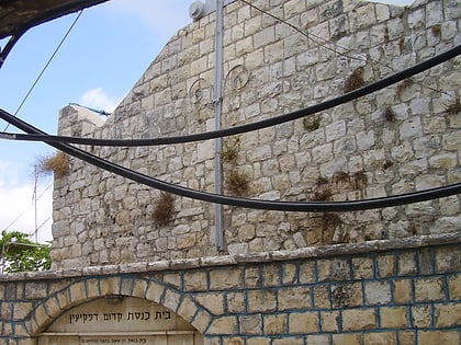 Synagogue
Peki'in Synagogue
120 min walk • The Peki’in Synagogue, is a synagogue located in the centre of Peki'in, Northern Israel. The current building was erected in 1873, on the site of older ones.
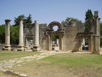 Synagogue
Bar'am National Park
48 min walk • Bar'am National Park is a national park in Israel, between kibbutz Sasa and moshav Dovev, near the Lebanese border. On the grounds of the park is a synagogue from the Talmudic period.
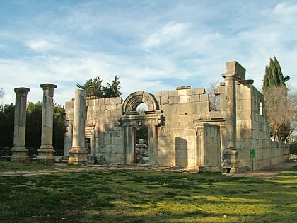 Archaeological site
Kafr Bir'im
52 min walk • Kafr Bir'im, also Kefr Berem, was a former village in Mandatory Palestine, located in modern-day northern Israel, 4 kilometers south of the Lebanese border and 11.5 kilometers northwest of Safed. The village was situated 750 meters above sea level.
 Town
TownPeki'in
120 min walk • Peki'in or Buqei'a, is a Druze/Arab town with local council status in Israel's Northern District. It is located eight kilometres east of Ma'alot-Tarshiha in the Upper Galilee. In 2019 it had a population of 5,893.
 Town
TownHurfeish, Upper Galilee
64 min walk • Hurfeish is a Druze town in the Northern District of Israel. In 2019 it had a population of 6,410.
 Nature, Natural attraction, Mountain
Har HaAri
137 min walk • Har HaAri is a mountain in the Upper Galilee in northern Israel.
 Village
Beit Jann
116 min walk • Beit Jann is a Druze village on Mount Meron in northern Israel. At 940 meters above sea level, Beit Jann is one of the highest inhabited locations in the country. In 2019 it had a population of 12,001.
 Neighbourhood
Fassuta, Upper Galilee
123 min walk • Fassouta is a local council on the northwestern slopes of Mount Meron in the Northern District of Israel, south of the Lebanese border. In 2019 it had a population of 3,172, nearly all of whom are Melkite Christians.