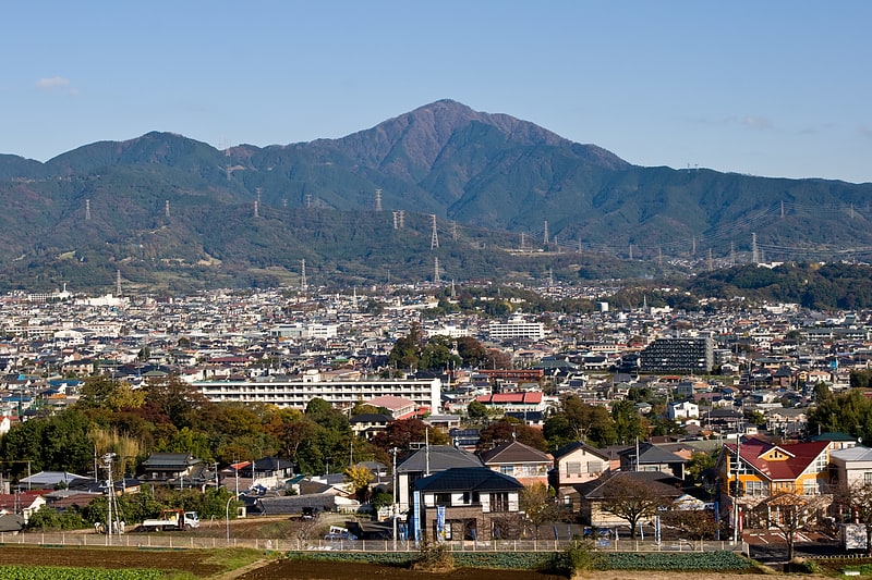
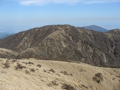
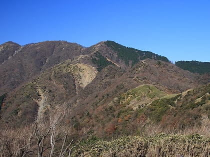
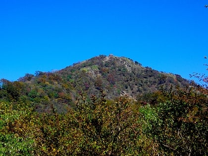
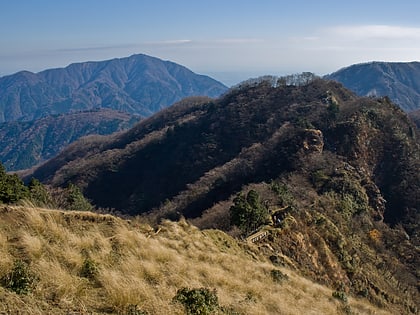
Mount Hiru, Tanzawa-Ōyama Quasi-National Park
#4 among attractions in Tanzawa-Ōyama Quasi-National Park

Facts and practical information
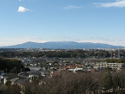
Mount Hiru is the tallest mountain of the Tanzawa Mountains with a height of 1,675 metres. ()
相模原 (xiang mo yuan)Tanzawa-Ōyama Quasi-National Park Japan
Tanzawa-Ōyama Quasi-National Park plan & book
Unleash the traveler in you — discover the cheapest flight deals, find the perfect hotel or hostel nearby, and search for the best car rental prices. Travel at your own pace to discover new places and enjoy your journey.
Mount Hiru – popular in the area (distance from the attraction)
Nearby attractions include: Mount Ōyama, Mount Tanzawa, Mount Shindainichi, Lake Tanzawa.
 Natural attraction, Park, Mountain
Mount Ōyama, Tanzawa-Ōyama Quasi-National Park
155 min walk • Mount Ōyama, also Mount Afuri or Mount Kunimi, is a 1,252-metre-high mountain situated on the border of Isehara, Hadano and Atsugi in Kanagawa Prefecture, Japan. Together with Mount Tanzawa and other mountains in the Tanzawa Mountains it forms the Tanzawa-Ōyama Quasi-National Park.
 Nature, Natural attraction, Mountain
Mount Tanzawa, Tanzawa-Ōyama Quasi-National Park
41 min walk • Mount Tanzawa is a mountain of the Tanzawa Mountains, with an elevation of 1,567.1 metres. Its summit marks the border between Sagamihara, Kiyokawa in Aikō District, and Yamakita in Ashigarakami District.
 Nature, Natural attraction, Mountain
Mount Shindainichi, Hadano
83 min walk • Mount Shindainichi is a peak of the Tanzawa Mountains with an elevation of 1,340 metres, and is located due east of Mount Tō. It is located within the boundary of the Tanzawa-Ōyama Quasi-National Park.
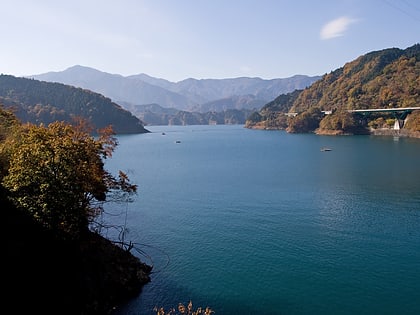
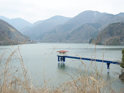 Natural attraction, Body of water, Park
Lake Tanzawa, Yamakita
178 min walk • Lake Tanzawa, is a lake located to the east of Mt. Fuji in Yamakita town, Ashigarakami district, in the Kanagawa Prefecture of Japan. The lake and its surroundings are frequently visited during fall to admire autumn colors.
 Nature, Natural attraction, Mountain
Mount Tō, Tanzawa-Ōyama Quasi-National Park
67 min walk • Mount Tō is a 1,490.9 m mountain of Tanzawa Mountains, located on the border of Kiyokawa, Hadano and Yamakita in Kanagawa, Japan.
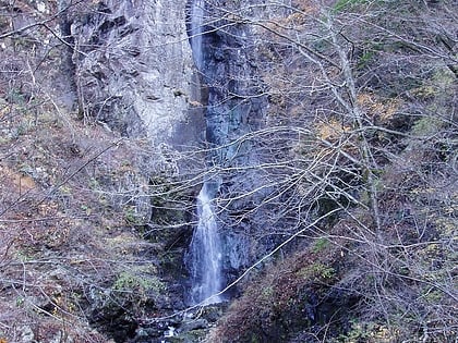 Nature, Natural attraction, Waterfall
Hayato Great Falls, Tanzawa-Ōyama Quasi-National Park
32 min walk • Hayato Great Falls is a waterfall on the Hayato River within the boundaries of the Tanzawa-Ōyama Quasi-National Park, in Sagamihara, Kanagawa Prefecture, Japan.
 Nature, Natural attraction, Mountain
Mount Chigogabaka, Tanzawa-Ōyama Quasi-National Park
67 min walk • Mount Chigogabaka is a 596.3 m mountain of Tanjō Mountains, located Iwatani, Yamada, Kita-ku, Kobe, Hyōgo, Japan.
 Tree
TreeHoukisugi at Nakagawa
125 min walk • Houkisugi or Hōkisugi at Nakagawa is a 2000-year-old Japanese cedar at Nakagawa Settlement, Yamakita town, Ashigarakami District, Kanagawa Prefecture, Japan. The tree was revered by locals because it prevented a great fire from spreading in 1904. There is still visible fire damage on the tree.
 Nature, Natural attraction, Natural feature
Tanzawa Mountains, Tanzawa-Ōyama Quasi-National Park
23 min walk • The Tanzawa Mountains are a mountain range in the Kantō region in Japan. The mountain range covers the northwestern part of Kanagawa Prefecture and touches the prefecture borders of Shizuoka Prefecture to the west and the Yamanashi Prefecture to the north.
 Nature, Natural attraction, Mountain
Gyoja Dake, Tanzawa-Ōyama Quasi-National Park
96 min walk • Gyoja-dake is a 1,180-meter-high mountain on the Tanzawa Omote Ridge. It is located between Shin-Dainichi and Karasuboyama. Gyoja-dake is 300 m northwest of the 1,209 m peak from which the Seijiro Ridge descends.
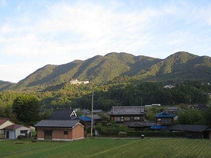
 Nature, Natural attraction, Lake
Lake Miyagase, Tanzawa-Ōyama Quasi-National Park
153 min walk • Lake Miyagase is a lake within the Aiko District of Kanagawa, Japan, located between Sagamihara and Atsugi. The lake offers views of Tanzawa Mountains, including Mount Hiru.