Shimizu Mega-City Pyramid, Tokyo
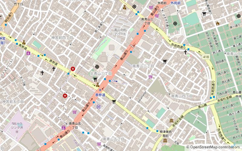
Map
Facts and practical information
The Shimizu TRY 2004 Mega-City Pyramid is a proposed Shimizu Corporation project for the construction of a massive self sustaining arcology-pyramid over Tokyo Bay in Japan that have businesses, parks, everything anyone could ever need. The structure would house 1,000,000 people. The structure would be 2,004 meters high, including five stacked trusses, each with similar dimensions to that of the Great Pyramid of Giza. This pyramid would help answer Tokyo's increasing lack of space, although the project would only handle a small fraction of the population of the Greater Tokyo Area. ()
Getting there by public transportation
Public transportation stops near this location
- Metro
- Bus
- Train
 Metro
Metro
- Calculate routeOmotesando Station 2 min walk
- Calculate routeKita-Aoyama-sanchome 5 min walk
- Calculate routeMinami-Aoyama-sanchome-kosaten 5 min walk
- Calculate routeOmote-sando 3 min walk
- Calculate routeGaiemmae 10 min walk
- Calculate routeMeiji-jingumae 'Harajuku' 14 min walk
- Calculate routeHarajuku 18 min walk
- Calculate routeShibuya 24 min walk
- Calculate routeShinanomachi 27 min walk
- Calculate routeSendagaya 28 min walk
Maps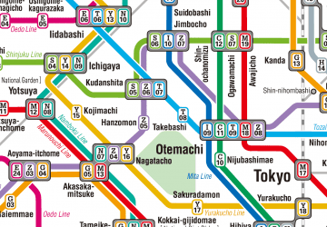 Metro
Metro
MetroDay trips


Frequently Asked Questions (FAQ)
Which popular attractions are close to Shimizu Mega-City Pyramid?
Nearby attractions include Minami-Aoyama, Tokyo (3 min walk), Li can daogaden / urasando-garden, Tokyo (7 min walk), Jingūmae, Tokyo (8 min walk), Nezu Museum, Tokyo (8 min walk).
How to get to Shimizu Mega-City Pyramid by public transport?
The nearest stations to Shimizu Mega-City Pyramid:
Bus
Metro
Train
Bus
- Omotesando Station • Lines: 神宮の杜ルート, 青山ルート (2 min walk)
- Kita-Aoyama-sanchome • Lines: 神宮の杜ルート, 黒77 (5 min walk)
Metro
- Omote-sando • Lines: C, Dt;Z, Dt;Z;Ts;Tn, G, Z (3 min walk)
- Gaiemmae • Lines: G (10 min walk)
Train
- Harajuku (18 min walk)
- Shibuya (24 min walk)