Panemunės paplūdimys, Kaunas

Gallery (1)
Map
Map
Facts and practical information
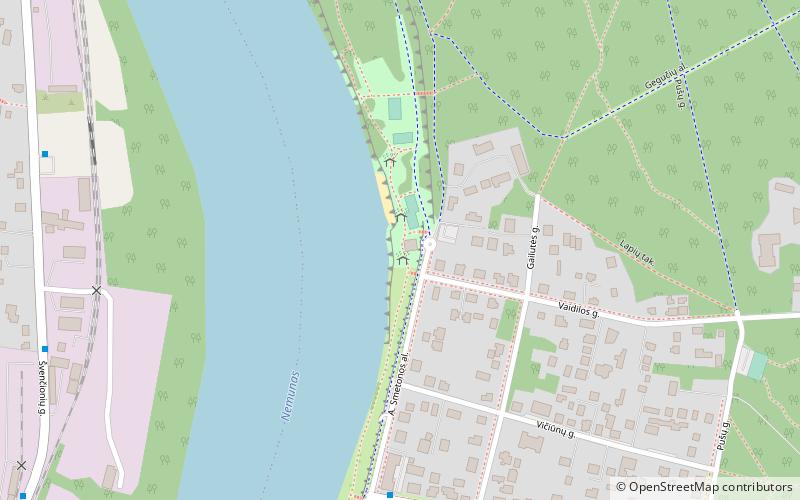
Panemunės paplūdimys (address: A. Smetonos al. 4) is a place located in Kaunas (Kauno county) and belongs to the category of beach.
It is situated at an altitude of 79 feet, and its geographical coordinates are 54°52'31"N latitude and 23°57'56"E longitude.
Planning a visit to this place, one can easily and conveniently get there by public transportation. Panemunės paplūdimys is a short distance from the following public transport stations: Gailutės g. (bus, 6 min walk), Clinic of Sanciai (trolleybus, 31 min walk).
Among other places and attractions worth visiting in the area are: Šančiai (neighbourhood, 24 min walk), Panemunes Park Beach (bridge, 25 min walk), Panemunė (neighbourhood, 26 min walk).
Coordinates: 54°52'31"N, 23°57'56"E
Address
A. Smetonos al. 4Kaunas
ContactAdd
Social media
Add
Getting there by public transportation
Public transportation stops near this location
- Bus
- Trolleybus
 Bus
Bus
- Calculate routeGailutės g. 6 min walk
- Calculate routeŠvenčionių g. 9 min walk
- Calculate routeSenoji rampa 9 min walk
- Calculate routeJ. Staugaičio g. 10 min walk
- Calculate routeClinic of Sanciai 31 min walk
Day trips


Frequently Asked Questions (FAQ)
How to get to Panemunės paplūdimys by public transport?
The nearest stations to Panemunės paplūdimys:
Bus
Trolleybus
Bus
- Gailutės g. • Lines: 3 (6 min walk)
- Švenčionių g. • Lines: 38 (9 min walk)
Trolleybus
- Clinic of Sanciai • Lines: 1, 4 (31 min walk)