Sandringham, Auckland
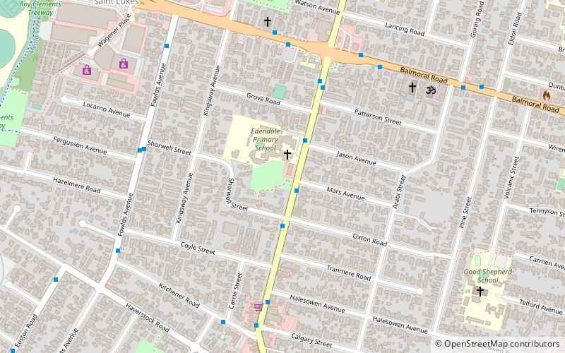
Map
Facts and practical information
Sandringham is a suburb of Auckland, New Zealand. It is a multi-ethnic suburb with a population of over 12,000. ()
Coordinates: 36°53'18"S, 174°44'13"E
Address
Central Auckland (Sandringham)Auckland
ContactAdd
Social media
Add
Getting there by public transportation
Public transportation stops near this location
- Bus
- Train
 Bus
Bus
- Calculate routeSandringham Road 6 min walk
- Calculate routeArabi Street 9 min walk
- Calculate routeWestfield Saint Lukes 12 min walk
- Calculate routeDominion Road 14 min walk
- Calculate routeMorningside 24 min walk
- Calculate routeKingsland 30 min walk
- Calculate routeBaldwin Avenue 30 min walk
Day trips


Frequently Asked Questions (FAQ)
Which popular attractions are close to Sandringham?
Nearby attractions include Saint Marys Bay, Auckland (13 min walk), Dominion Road, Auckland (19 min walk).
How to get to Sandringham by public transport?
The nearest stations to Sandringham:
Bus
Train
Bus
- Sandringham Road • Lines: Out (6 min walk)
- Arabi Street • Lines: Out (9 min walk)
Train
- Morningside (24 min walk)
- Kingsland (30 min walk)