Tverrvatnet

Gallery (3)
Map
Map
Gallery
Facts and practical information
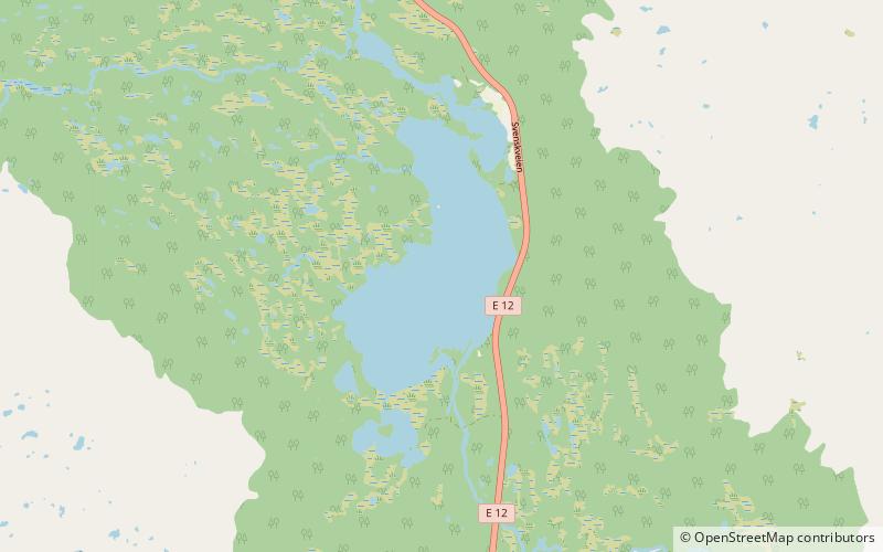
Tverrvatnet or Tvervatnet is a lake in the municipality of Rana in Nordland county, Norway. The European route E12 highway passes along the northern and eastern shores of the lake between the town of Mo i Rana and the border with Sweden. Tverrvatnet gets its name from the fact that it is located "across", in a north–south direction, while most lakes in Rana are located in an east–west direction. ()
Alternative names: Length: 8202 ftWidth: 3281 ftElevation: 1637 ft a.s.l.Coordinates: 66°14'10"N, 14°33'13"E
Location
Nordland
ContactAdd
Social media
Add
Day trips

