Asilo de San Vicente de Paul, Manila
Map
Facts and practical information
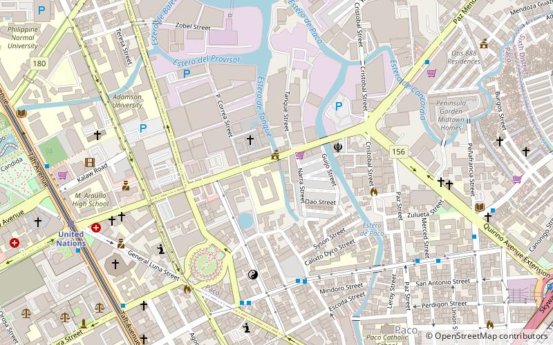
Asilo de San Vicente de Paul is an orphanage located on UN Avenue in Manila, Philippines. It is run by the Daughters of Charity of Saint Vincent de Paul. ()
Coordinates: 14°35'3"N, 120°59'28"E
Address
PacoManila
ContactAdd
Social media
Add
Getting there by public transportation
Public transportation stops near this location
- Metro
- Bus
- Light rail
- Train
- Ferry
 Metro
Metro
- Calculate routeAngel Linao 6 min walk
- Calculate routeApacible-Romualdez 8 min walk
- Calculate routeUnited Nations/WHO 12 min walk
- Calculate routeQuirino Extension 12 min walk
- Calculate routeUnited Nations 12 min walk
- Calculate routePedro Gil 15 min walk
- Calculate routeCentral Terminal 23 min walk
- Calculate routeQuirino 25 min walk
- Calculate routePaco 17 min walk
- Calculate routeSan Andres 25 min walk
- Calculate routeLawton 27 min walk
- Calculate routeEscolta 32 min walk
- Calculate routeLegarda 30 min walk
Day trips


Frequently Asked Questions (FAQ)
Which popular attractions are close to Asilo de San Vicente de Paul?
Nearby attractions include Paco Park, Manila (7 min walk), Plaza Rueda, Manila (11 min walk), Iglesia Filipina Independiente National Cathedral, Manila (11 min walk), United Nations Avenue, Manila (11 min walk).
How to get to Asilo de San Vicente de Paul by public transport?
The nearest stations to Asilo de San Vicente de Paul:
Bus
Light rail
Train
Ferry
Metro
Bus
- Angel Linao • Lines: 301 (6 min walk)
- Apacible-Romualdez • Lines: 301 (8 min walk)
Light rail
- United Nations • Lines: 1 (12 min walk)
- Pedro Gil • Lines: 1 (15 min walk)
Train
- Paco (17 min walk)
- San Andres (25 min walk)
Ferry
- Lawton • Lines: Pasig River Ferry (27 min walk)
- Escolta • Lines: Pasig River Ferry (32 min walk)
Metro
- Legarda • Lines: 2 (30 min walk)