Bukit Pasoh Road, Central Area

Gallery (1)
Map
Map
Facts and practical information
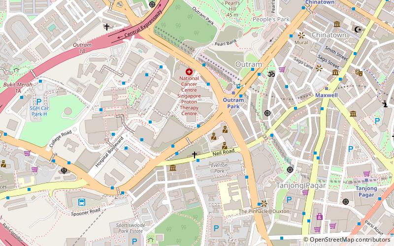
Bukit Pasoh Road is a road in Tanjong Pagar within the Outram Planning Area of Singapore. The road starts from Neil Road which is one way, but becomes two ways, when the road forks out into two parts, with one becoming Teo Hong Road, with both roads ending at New Bridge Road. The road is mainly lined with conserved shophouses and houses a high-end boutique hotel known as the New Majestic Hotel. ()
Coordinates: 1°16'45"N, 103°50'18"E
Address
Central Region (Bukit Merah)Central Area
ContactAdd
Social media
Add
Getting there by public transportation
Public transportation stops near this location
- Metro
- Bus
- Train
 Metro
Metro
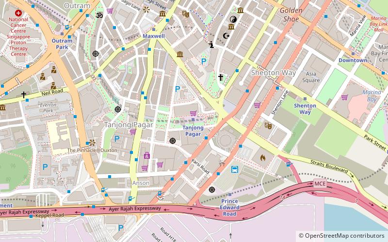
- Calculate routeOutram Park Station Exit F/SGH 1 min walk
- Calculate routeAfter Hospital Drive 3 min walk
- Calculate routeBefore Neil Road 3 min walk
- Calculate routeBlk 3 3 min walk
- Calculate routeOutram Park 5 min walk
- Calculate routeCantonment 12 min walk
- Calculate routeTanjong Pagar 14 min walk
- Calculate routeChinatown 15 min walk
- Calculate routeVivoCity 38 min walk
Maps Metro
Metro
MetroDay trips


Frequently Asked Questions (FAQ)
Which popular attractions are close to Bukit Pasoh Road?
Nearby attractions include Central Police Division, Central Area (3 min walk), Baba House (5 min walk), Pearl Bank Apartments (7 min walk), SGH War Memorial (8 min walk).
How to get to Bukit Pasoh Road by public transport?
The nearest stations to Bukit Pasoh Road:
Bus
Metro
Train
Bus
- Outram Park Station Exit F/SGH • Lines: 124, 143, 147, 166, 197, 61, 961, 961M (1 min walk)
- After Hospital Drive • Lines: 12, 121, 122, 124, 12e, 143, 147, 166, 167, 174, 174e, 190, 196, 197, 2, 2A, 54, 61, 961, 961M, Ct18, Ct28, Ct8 (3 min walk)
Metro
- Outram Park • Lines: Ewl, Nel, Tel (5 min walk)
- Cantonment • Lines: Ccl (12 min walk)
Train
- VivoCity (38 min walk)