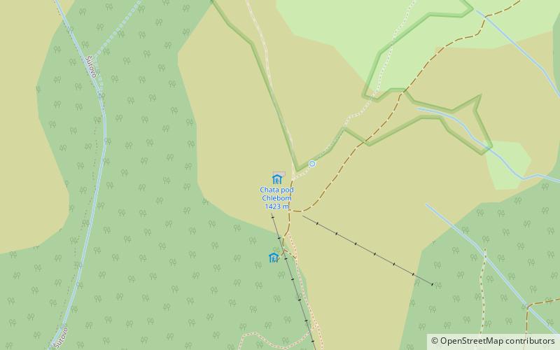
Chata pod Chlebom, Malá Fatra National Park
#8 among attractions in Malá Fatra National Park

Facts and practical information
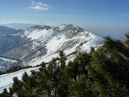
Chata under bread - a mountain shelter in Mała Fatra, Slovakia. He is the highest mountain shelter in Little Fatra.
Malá Fatra National Park plan & book
Unleash the traveler in you — discover the cheapest flight deals, find the perfect hotel or hostel nearby, and search for the best car rental prices. Travel at your own pace to discover new places and enjoy your journey.
Chata pod Chlebom – popular in the area (distance from the attraction)
Nearby attractions include: Vrátna dolina, Veľký Rozsutec, Šútovský vodopád, Veľký Kriváň.
 Winter sport, Ski area
Vrátna dolina, Terchová
83 min walk • Nestled in the heart of the Mala Fatra mountains, Vrátna dolina is a picturesque valley located in the city of Terchová, Slovakia. Renowned for its breathtaking landscapes and premier ski area, this valley is a winter sports enthusiast's paradise.
 Natural attraction, Nature, Mountain
Veľký Rozsutec, Malá Fatra National Park
106 min walk • Veľký Rozsutec, a majestic peak in the heart of the Malá Fatra National Park in Slovakia, is a natural wonder that captures the essence of raw beauty and adventure. This mountain, rising to an elevation of 1,609 meters, is characterized by its distinctive limestone...
 Natural attraction, Nature, Waterfall
Šútovský vodopád, Malá Fatra National Park
40 min walk • Šútovský vodopad is a waterfall in Slovakia located in the Malá Fatra mountains, 4 kilometres north of the town of Šútovo.
 Nature, Natural attraction, View point
Veľký Kriváň, Terchová
24 min walk • Veľký Kriváň is the highest mountain in the Lesser Fatra.
 Natural attraction, Nature, Mountain
Stratenec, Malá Fatra National Park
94 min walk • Stratenec is 4,962 feet AMSL high mountain in the Lesser Fatra. This limestone mountain covered with dwarf-pines is situated in west part of the main crest of Krivanska Mala Fatra mountain range.
 Natural attraction, Nature, Natural feature
Malá Fatra, Malá Fatra National Park
24 min walk • Malá Fatra is a mountain range in the Western Carpathians in the north-west of Central Slovakia. In the geomorphological system, it is a part of the Fatra-Tatra Area. It is situated approximately between the cities of Nitrianske Pravno, Strečno, Martin and Zázrivá.
 Memorial
symbolický cintorín - Vrátna, Malá Fatra National Park
45 min walk • Cemetery of the Mountains victims in Little Fatra - a symbolic cemetery located in an old valley in the Mała Fatra mountain band in Slovakia. It is located at the Vrátna Tourist Center, near the lower station of the Vrátna - bread.
 Hiking, Alpine hut
Chata Vrátna, Malá Fatra National Park
49 min walk • Cottage Vrátna is a mountain cottage at the end of Vrátná dolina in Krivánska Fatra. It is located at the foot of Veľký Krivan at an altitude of 740 m above sea level. m. Directly in the cottage is the lower station of the new cable...
 Hiking, Trail, Alpine hut
Chata pod Suchým, Malá Fatra National Park
132 min walk • Chata Pod Suchým - a mountain shelter located in Mała Fatra at an altitude of about 1075 m a.s.l. Near the Suchý summit. It is located in the Little Fatra National Park and its part - the Suchý nature reserve.
 Hiking, Restaurant, Alpine hut
Chata na Grúni, Malá Fatra National Park
68 min walk • Chata na Grúni - Slovak Tourist Hostel located in the side branch of the main comb of little Fatra Krivańska, which runs from the south of Grúň and through Grúň falls to the Vrátna Dolina. The shelter is located at a height of 970 m, at a large flattening of the area under the top of Grúnia.
 49°8'53"N • 18°57'4"E
Chata pod Kľačianskou Magurou, Malá Fatra National Park
128 min walk • Hiking, Alpine hut


