Älpliseehorn
#1445 among destinations in Switzerland


Facts and practical information
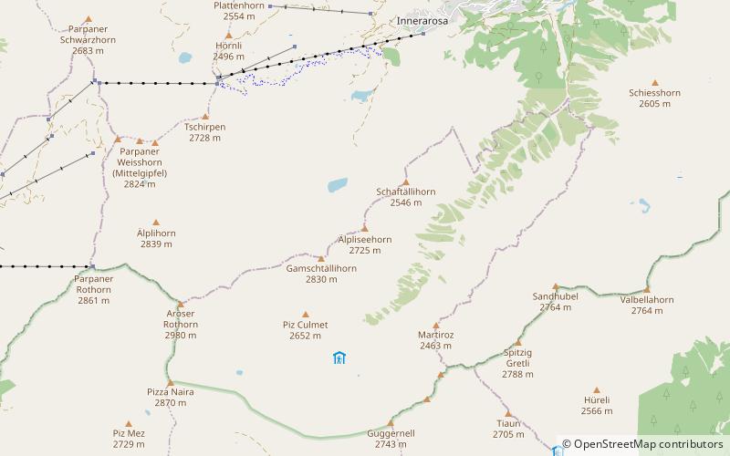
The Älpliseehorn is a mountain of the Plessur Alps, located south of Arosa in Graubünden. It is part of the range east of the Aroser Rothorn. On the north side of the mountain lies the Älplisee. ()
GraubündenSwitzerland
Älpliseehorn – popular in the area (distance from the attraction)
Nearby attractions include: Arosa Lenzerheide, Obersee, Heidsee, Aroser Weisshorn.
2.3 miNW
Winter sport, Ski areaArosa Lenzerheide
59 min walk • Nestled in the heart of the Swiss Alps, Arosa Lenzerheide stands as a premier ski area, offering a sublime blend of snow-covered slopes, pristine winter landscapes, and state-of-the-art facilities. This dual-region resort, connected by the Urdenbahn cable car, boasts...
3 miNE
Nature, Natural attraction, LakeObersee, Arosa
77 min walk • Nestled in the serene mountain landscape of Arosa, Switzerland, the Obersee is a pristine alpine lake that beckons to nature lovers and outdoor enthusiasts alike. This tranquil body of water is surrounded by lush forests and rugged peaks, providing a picturesque...
4.6 miW
Alpine lake with trails and scenic viewsHeidsee
117 min walk • Nestled in the heart of the Swiss Alps lies the serene and picturesque Heidsee, a jewel of a lake that offers both tranquility and adventure to its visitors. Surrounded by lush green meadows and flanked by the majestic peaks of the Graubünden canton, Heidsee is a...
2.9 miN
Alpine mountain with cable-car accessAroser Weisshorn
75 min walk • Nestled in the breathtaking Swiss Alps, the Aroser Weisshorn stands as a majestic testament to the grandeur of nature. This impressive mountain, part of the Plessur range in the canton of Graubünden, Switzerland, soars to an altitude of 2,653 meters, offering...
4.8 miSE
BridgeWiesen Viaduct
122 min walk • The Wiesen Viaduct is a single-track railway viaduct, made from concrete blocks with dimension stone coverage. It spans the Landwasser southwest of the hamlet of Wiesen, in the canton of Grisons, Switzerland.
1.8 miSW
Nature, Natural attraction, MountainAroser Rothorn
46 min walk • The Aroser Rothorn is the highest mountain of the Plessur Alps. It is located between Arosa and Lenzerheide in the canton of Graubünden and with a summit elevation of 2,980 metres above sea level.
2.7 miNE
Nature, Natural attraction, MountainTschuggen, Arosa
69 min walk • The Tschuggen is a mountain of the Plessur Alps, overlooking Arosa in the Swiss canton of Graubünden. A gondola lift and a chairlift link the top of the mountain with the town and resort of Arosa — the base station of the chairlift is near to Arosa railway station.
3.6 miSW
Nature, Natural attraction, MountainLenzerhorn
93 min walk • The Lenzerhorn is a mountain of the Plessur Alps, located east of Lenzerheide in the canton of Graubünden. It has an elevation of 2,906 metres and is, after the Aroser Rothorn, the second highest peak of the Plessur Alps.
2.6 miE
Nature, Natural attraction, MountainValbellahorn
66 min walk • The Valbellahorn is a mountain of the Plessur Alps, located between Arosa and Wiesen in the canton of Graubünden.
1.8 miE
Nature, Natural attraction, MountainSandhubel
46 min walk • The Sandhubel is a mountain of the Plessur Alps, located south of Arosa in the canton of Graubünden. It lies north of the Guggernellgrat.
4.6 miNW
Nature, Natural attraction, MountainGürgaletsch
119 min walk • The Gürgaletsch is a mountain of the Plessur Alps, located between Churwalden and Tschiertschen in the Swiss canton of Graubünden.
