Lac du Vernex, Rossinière
#1 among attractions in Rossinière
![Lac du Vernex location map](https://tzmedia.b-cdn.net/media/images/static-maps/ch/46_4637_7_07136.jpg)
Facts and practical information
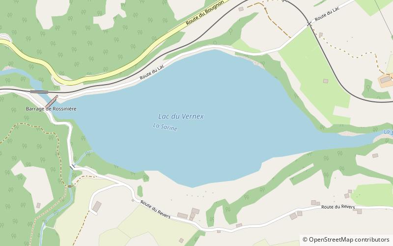
Lac du Vernex is a reservoir on the Saane/Sarine river at Rossinière, in the Pays d'Enhaut of the canton of Vaud. It lies at an elevation of 859 m above sea level, between the Pointe de Cray and Planachaux mountains. ()
Rossinière Switzerland
Rossinière plan & book
Unleash the traveler in you — discover the cheapest flight deals, find the perfect hotel or hostel nearby, and search for the best car rental prices. Travel at your own pace to discover new places and enjoy your journey.
Lac du Vernex – popular in the area (distance from the attraction)
Nearby attractions include: Rochers de Naye, Haut-Intyamon, Dent de Lys, Lac de Lessoc.
5 miSWTowering peak with a railway to the topRochers de Naye, Montreux
129 min walk • The Rochers de Naye is a mountain of the Swiss Alps, overlooking Lake Geneva near Montreux and Villeneuve, in the canton of Vaud.
3.8 miNCity hallHaut-Intyamon
97 min walk • Nestled in the serene pre-Alpine valley of Gruyère in the canton of Fribourg, Haut-Intyamon is a picturesque municipality that captures the essence of Switzerland's bucolic charm. At the heart of this tranquil community lies the Haut-Intyamon City Hall, an emblem of...
4.4 miNWNature, Natural attraction, MountainDent de Lys
114 min walk • The Dent de Lys is a mountain in the Bernese Alps, in the canton of Fribourg.
2.4 miNWNature, Natural attraction, LakeLac de Lessoc
62 min walk • Lac de Lessoc is a reservoir on the Saane/Sarine river between Lessoc and Montbovon in the Canton of Fribourg, Switzerland. The lake's surface area is 20 ha. The Lessoc dam with a height of 33 m was completed in 1976.
4.8 miWNature, Natural attraction, MountainDent de Jaman
122 min walk • The Dent de Jaman is a mountain above Montreux, situated north of the Rochers de Naye.
4.1 miENature, Natural attraction, MountainRocher du Midi
106 min walk • The Rocher du Midi is a mountain in the western Bernese Alps, overlooking Château d'Oex in the canton of Vaud. It is located on the massif between the valley of the Sarine and L'Etivaz and culminating at the Gummfluh.
4.4 miWNature, Natural attraction, MountainCape au Moine
113 min walk • The Cape au Moine is a mountain of the Swiss Prealps, located on the border between the cantons of Vaud and Fribourg. It lies north of the Col de Jaman and south of the Col de Soladier, among of a crest of peaks extending roughly north into Fribourg to the Dent de Lys, on the range between Lake Geneva and the valley of Gruyère.
4.6 miNENature, Natural attraction, MountainPointe de Paray
119 min walk • The Pointe de Paray is a mountain of the Swiss Prealps, located on the border between the cantons of Fribourg and Vaud. It has a height of 2,375 metres above sea level, making it both the third highest summit of the Vanil Noir massif and the canton of Fribourg.
3.2 miNENature, Natural attraction, MountainVanil Carré
82 min walk • The Vanil Carré is a mountain in the western Bernese Alps, located on the border between the cantons of Fribourg and Vaud. It lies on the massif separating the valleys of Gruyère and Pays d'Enhaut, which culminates at the Vanil Noir.
4.5 miSWNature, Natural attraction, MountainPointe d'Aveneyre
115 min walk • The Pointe d'Aveneyre is a mountain of the Swiss Prealps, located east of Villeneuve in the canton of Vaud. It lies south of the Rochers de Naye, on the range overlooking Lake Geneva.
0.6 miEMemorial, Vernacular architectureGrand Chalet, Rossinière
17 min walk • The Grand Chalet of Rossinière is one of the oldest chalets in Switzerland, dating to the 18th century. It is located in Rossinière and classed as a historic monument. Claude Roy wrote of it: The Grand Chalet, a caravel washed up on a mountain, a Shinto temple.. With its architecture in white wood and balconies of lace.