Landwasser Viaduct, Filisur
#1 among attractions in Filisur
Facts and practical information
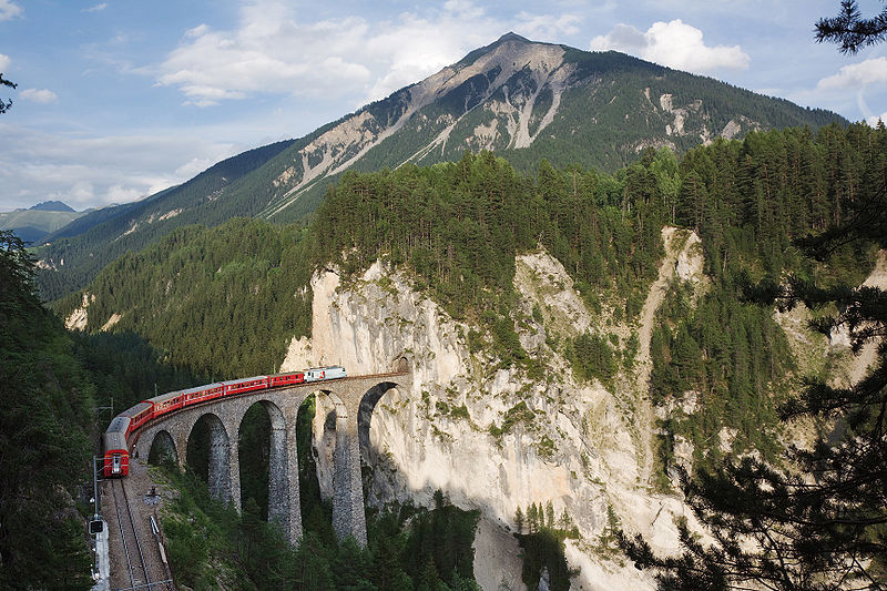
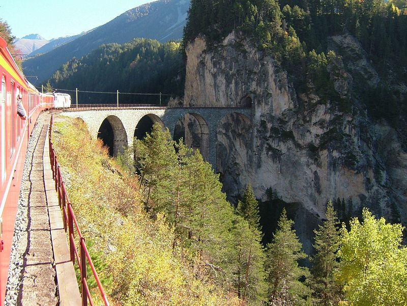
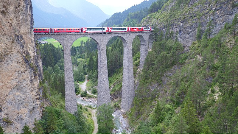
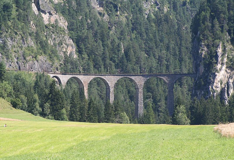
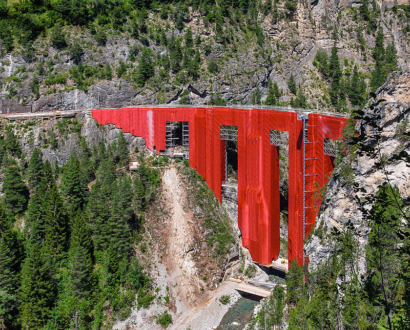
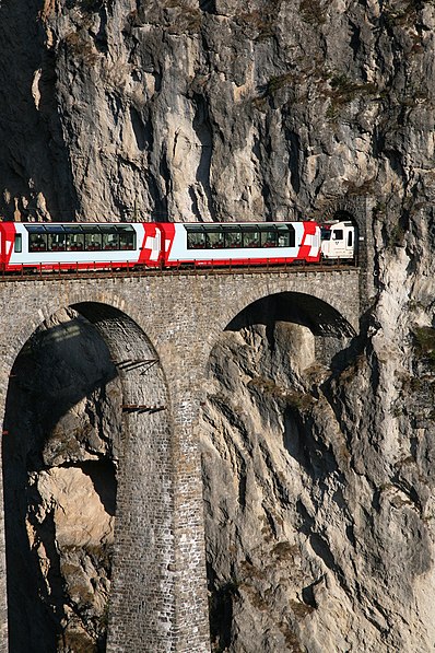
The Landwasser Viaduct is a single-track six-arched curved limestone railway viaduct. It spans the Landwasser between Schmitten and Filisur, in the canton of Graubünden, Switzerland. ()
Filisur Switzerland
Filisur plan & book
Unleash the traveler in you — discover the cheapest flight deals, find the perfect hotel or hostel nearby, and search for the best car rental prices. Travel at your own pace to discover new places and enjoy your journey.
Landwasser Viaduct – popular in the area (distance from the attraction)
Nearby attractions include: Greifenstein Castle, Wiesen Viaduct, Belfort, Aroser Rothorn.
- 1 miEForts and castles
Greifenstein Castle, Filisur
25 min walk • Greifenstein Castle is a ruined castle in the municipality of Filisur of the Canton of Graubünden in Switzerland. It is included on the register of the Swiss Inventory of Cultural Property of National and Regional Significance.
- 2.1 miNEBridge
Wiesen Viaduct
54 min walk • The Wiesen Viaduct is a single-track railway viaduct, made from concrete blocks with dimension stone coverage. It spans the Landwasser southwest of the hamlet of Wiesen, in the canton of Grisons, Switzerland.
- 3.1 miWForts and castles
Belfort
79 min walk • Belfort Castle is a ruined castle in the municipality of Brienz/Brinzauls of the Canton of Graubünden in Switzerland. It is a Swiss heritage site of national significance.
- 4.9 miNWNature, Natural attraction, Mountain
Aroser Rothorn
124 min walk • The Aroser Rothorn is the highest mountain of the Plessur Alps. It is located between Arosa and Lenzerheide in the canton of Graubünden and with a summit elevation of 2,980 metres above sea level.
- 5.5 miSNature, Natural attraction, Mountain
Piz Ela
140 min walk • Piz Ela is a mountain in the Albula Alps, overlooking Bergün, in the Swiss canton of Graubünden. It is located in the center of the nature park Parc Ela. There is a lake called Lai Grond to the south of Piz Ela.
- 4.8 miSNature, Natural attraction, Mountain
Corn da Tinizong
122 min walk • The Corn da Tinizong is a mountain of the Albula Alps, located between Savognin and Bergün, in the Swiss canton of Graubünden. Its large southern face overlooks the Pass digls Orgels.
- 4.8 miSNature, Natural attraction, Mountain
Piz Mitgel
122 min walk • Piz Mitgel is a mountain in the Albula Range of the Alps, overlooking Savognin, in the canton of Graubünden. Similarly to its higher neighbor, Corn da Tinizong, it has an almost vertical south face. A via ferrata leads to the summit.
- 4.2 miNWNature, Natural attraction, Mountain
Lenzerhorn
107 min walk • The Lenzerhorn is a mountain of the Plessur Alps, located east of Lenzerheide in the canton of Graubünden. It has an elevation of 2,906 metres and is, after the Aroser Rothorn, the second highest peak of the Plessur Alps.
- 4.3 miNNature, Natural attraction, Mountain
Valbellahorn
110 min walk • The Valbellahorn is a mountain of the Plessur Alps, located between Arosa and Wiesen in the canton of Graubünden.
- 4.1 miNNature, Natural attraction, Mountain
Sandhubel
106 min walk • The Sandhubel is a mountain of the Plessur Alps, located south of Arosa in the canton of Graubünden. It lies north of the Guggernellgrat.
- 4.9 miSEMuseum
Bahnmuseum Albula
125 min walk • The Albula Railway Museum is located at the Bergün/Bravuogn railway station of the Albula Railway of the Swiss Rhaetian Railway. The museum is in operation since 2012. The museum tells the history of the construction of the Albula Railway and shows many historical plans and artifacts.