Hohstock

Gallery (1)
Map
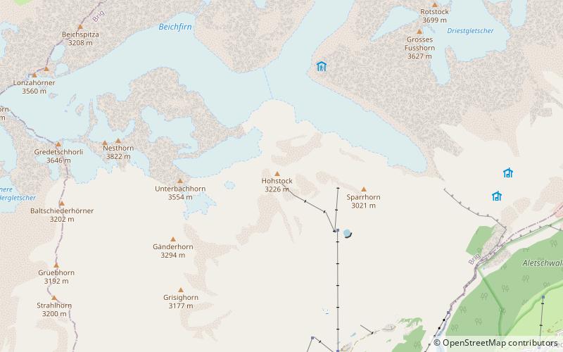
Map
Facts and practical information
The Hohstock is a mountain of the Bernese Alps, located north of Belalp in the Swiss canton of Valais. It lies on the range east of the Unterbächhorn, between the valley of the Oberaletsch Glacier and the cirque of Belalp. ()
Location
Valais
ContactAdd
Social media
Add
Day trips