Spitzmeilen
#612 among destinations in Switzerland
![Spitzmeilen location map](https://tzmedia.b-cdn.net/media/images/static-maps/ch/47_024_9_23635.jpg)
Facts and practical information
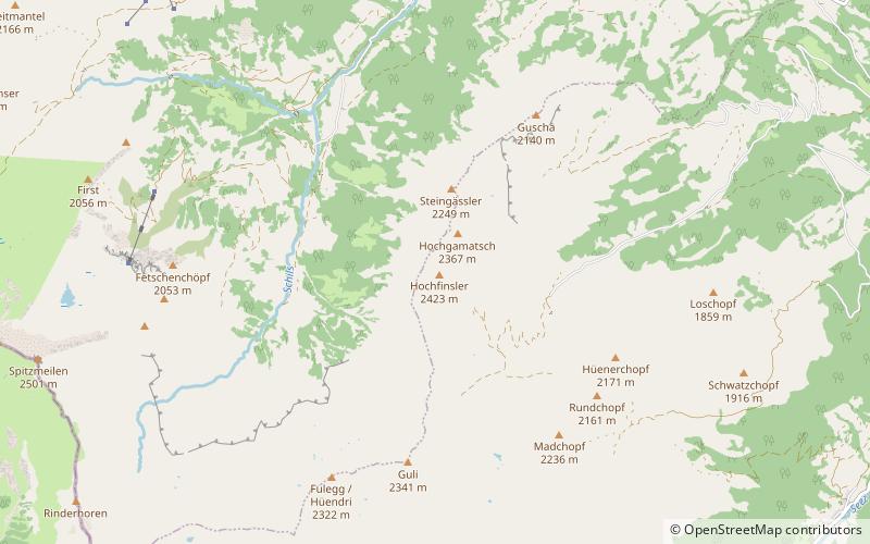
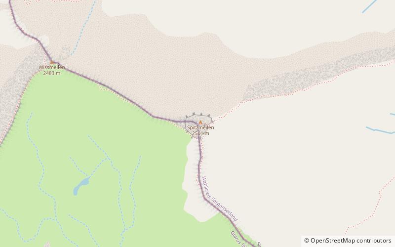
The Spitzmeilen is a mountain of the Glarus Alps, lying on the border between the Swiss cantons of Glarus and St. Gallen. It lies between the valleys of Schilstal and Sernftal. ()
GlarusSwitzerland
Spitzmeilen plan & book
Unleash the traveler in you — discover the cheapest flight deals, find the perfect hotel or hostel nearby, and search for the best car rental prices. Travel at your own pace to discover new places and enjoy your journey.
Spitzmeilen – popular in the area (distance from the attraction)
Nearby attractions include: Flums, Oberer Murgsee, Talalpsee, Nüenchamm.
6.1 miNEWinter sport, Ski areaFlums
157 min walk • Nestled in the heart of the Swiss Alps, Flums is a picturesque destination that beckons outdoor enthusiasts and winter sports aficionados alike. Renowned for its ski area, this charming town offers a serene escape with slopes that cater to both novice and experienced...
4 miWNature, Natural attraction, LakeOberer Murgsee
102 min walk • Oberer Murgsee is a lake in the Murg valley, in the canton of St. Gallen, Switzerland. It is the highest of the three Murgseen. The lake is drained by the Murgbach which empties into Lake Walen at Murg.
6.9 miNWNature, Natural attraction, LakeTalalpsee
177 min walk • Talalpsee or Talsee is a lake at an elevation of 1086 m above Filzbach in the Canton of Glarus, Switzerland. Its surface area is 3.2 ha.
7.2 miNWNature, Natural attraction, MountainNüenchamm
183 min walk • The Nüenchamm is a mountain of the Glarus Alps, overlooking the Walensee in the canton of Glarus. It is located west of the Mürtschenstock, between the Linth valley and the valley of the Talalpsee.
4.2 miWNature, Natural attraction, MountainGufelstock
108 min walk • The Gufelstock is a mountain of the Glarus Alps, overlooking Schwanden in the canton of Glarus. The border with the canton of St. Gallen runs on the northern base of the mountain.
6.1 miNWNature, Natural attraction, LakeSpaneggsee
156 min walk • Spaneggsee is a lake in Filzbach, Glarus, Switzerland. Its surface area is 4.7 ha.
3.7 miWNature, Natural attraction, LakeMurgseen
95 min walk • Murgseen are a group of lakes in Murgtal in the Canton of St. Gallen, Switzerland. The three lakes are drained by the Murgbach river, which empties into Lake Walen at Murg in the municipality of Quarten.
3 miENature, Natural attraction, MountainHochfinsler
77 min walk • The Hochfinsler is a mountain of the Glarus Alps, located south of Flums in the canton of St. Gallen. It lies on the range north of the Wissgandstöckli, that separates the Schilstal from the Weisstannental.
1 miNWNature, Natural attraction, MountainMagerrain
26 min walk • The Magerrain is a mountain of the Glarus Alps, located on the border between the cantons of Glarus and St. Gallen in Eastern Switzerland.
7.1 miNEForts and castlesGräpplang Castle
181 min walk • Gräpplang Castle is a castle in the municipality of Flums of the Canton of St. Gallen in Switzerland. It is a Swiss heritage site of national significance.
2.9 miWNature, Natural attraction, MountainBützistock
74 min walk • The Bützistock is a mountain of the Glarus Alps. It lies on the border between the cantons of Glarus and St. Gallen in Eastern Switzerland. The top is 2,496 m above sea level or 513 meters above the surrounding terrain. The width at the base is 18 km.