Löffelhorn
#1530 among destinations in Switzerland
Facts and practical information
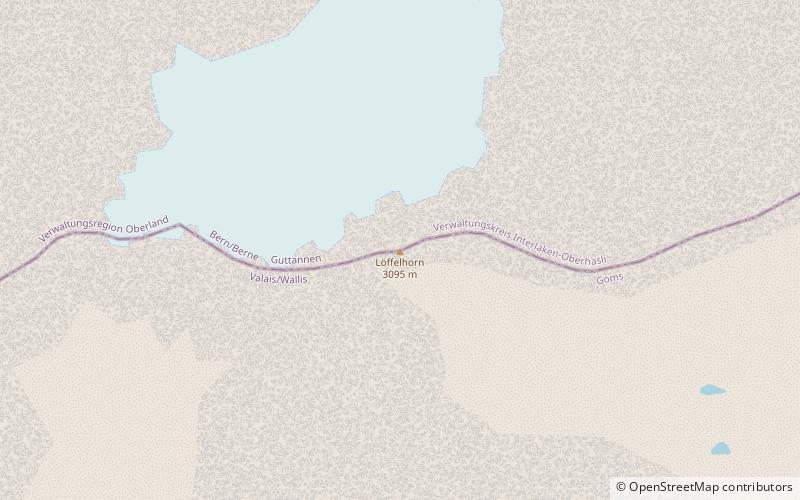
The Löffelhorn is a mountain of the Bernese Alps, located on the border between the Swiss cantons of Bern and Valais. It is part of the Aargrat, a range east of the Oberaarhorn that separates the valley of the Oberaar Glacier from the valley of Goms. ()
ValaisSwitzerland
Löffelhorn – popular in the area (distance from the attraction)
Nearby attractions include: Sidelhorn, Finsteraarrothorn, Grimselsee, Oberaarhorn.
4 miNENature, Natural attraction, MountainSidelhorn
102 min walk • The Sidelhorn is a mountain of the Bernese Alps, located west of the Grimsel Pass. It lies at the eastern end of the mountain chain between the Unteraar Glacier and the Rhone valley, named Aargrat.
4.3 miWMountainFinsteraarrothorn, Swiss Alps Jungfrau-Aletsch
109 min walk • The Finsteraarrothorn is a mountains of the Bernese Alps, overlooking the Fiescher Glacier in the canton of Valais. It lies at the southeastern end of the ridge descending from the Finsteraarhorn, between the Fiescher Glacier and the Studer Glacier.
4.1 miNENature, Natural attraction, LakeGrimselsee
105 min walk • The Grimselsee or Lake Grimsel is an artificial lake near the Grimsel Pass in the Canton of Berne, Switzerland. With a volume of 95 mio m³, it is larger than other hydroelectric reservoirs in the region: Oberaarsee, Räterichsbodensee and Gelmersee.
3 miWNature, Natural attraction, MountainOberaarhorn
77 min walk • The Oberaarhorn is a mountain of the Bernese Alps, located on the border between the Swiss cantons of Valais and Bern. Its summit is the tripoint between the basins of the Fiesch, Unteraar and Oberaar Glacier.
1.5 miNENature, Natural attraction, LakeOberaarsee
38 min walk • Oberaarsee is a hydroelectric reservoir in the Grimsel area, part of the municipality of Guttannen, Switzerland. Its surface area is 1.47 km². The Oberaar dam was completed in 1953, and is operated by Kraftwerke Oberhasli. It is drained by the Oberaarbach, which flows into the Grimselsee. The Oberaar glacier is located west of the lake.
3.1 miNAlpine hut, HikingLauteraar Hut
79 min walk • The Lauteraar Hut is a mountain hut of the Swiss Alpine Club, located south-west of Handegg in the canton of Bern. The hut lies at a height of 2,392 metres above sea level, above the Unteraar Glacier, at the foot of the Hienderstock in the Bernese Alps.
3.1 miSWNature, Natural attraction, MountainGalmihorn
78 min walk • The Galmihorn is a mountain of the Bernese Alps, overlooking the Fiescher Glacier in the canton of Valais. The main summit is distinguished by the name Vorderes Galmihorn and has an elevation of 3,506 metres.
3.1 miNWNature, Natural attraction, Natural featureUnteraargletscher
79 min walk • The Unteraargletscher, literally "Lower Aare-Glacier", is the larger of the two sources of the Aare river in the Bernese Alps. It emerges from the association of the Finsteraargletscher and the Lauteraargletscher and flows for about 6 km to the east down to the Grimselsee near the Grimsel Pass.
4 miNEMountainBrünberg, Swiss Alps Jungfrau-Aletsch
103 min walk • The Brünberg is a mountain of the Bernese Alps, overlooking the Grimselsee in the canton of Bern. It is composed of several summits, of which the highest has an elevation of 2,982 metres above sea level.
3.4 miNENature, Natural attraction, LakeTrübtensee
87 min walk • Trübtensee or Triebtenseewli is a lake in the municipality of Guttannen, Bernese Oberland, Switzerland. The reservoir's surface area is 0.1 km². Its dam was completed in the 1950s and holds a volume of 1.1 mio m³.
4.2 miNNature, Natural attraction, MountainHienderstock
108 min walk • The Hienderstock is a mountain in the Bernese Alps, located between the Gauli Glacier and the Unteraar Glacier, in the canton of Bern. Its main summit has an elevation of 3,307 metres above sea level.